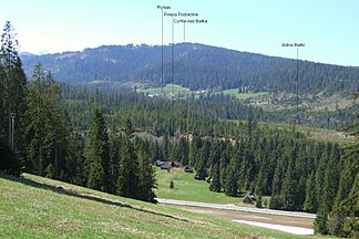
Bukovina Mountains
| Pogórze Bukowińskie | ||
|---|---|---|
| Highest peak | Cyrhla nad Białką ( 1155 m npm ) | |
| location | Poland | |
| part of | Western Carpathians | |
|
|
||
| Coordinates | 49 ° 19 ′ N , 20 ° 5 ′ E | |
The Bukowina Mountains (Polish: Pogórze Bukowińskie ) is a mountain range in the Polish Lesser Poland Voivodeship in the Powiat Tatrzański district and the Bukowina Tatrzańska municipality . It is located in the historical Podhale region .
location
The mountains are located north of the High Tatras (the border is the Oswald-Balzer-Weg panoramic road ), south of the Pieninen , east of the Pogórze Gubałowskie (the border is the mountain river Biały Dunajec ) and west of the Pogórze Spiskie , specifically its southern part Zipser Magura (border is the mountain river Białka ), in the mountain range of the Pogórze Spisko-Gubałowskie . It has the character of a low mountain range . The highest point is the Cyrhla nad Białką at 1155 meters .
natural reserve
The southern part of the mountain is in the Tatra National Park .
tourism
The Pogórze Bukowińskie is very densely populated and developed for tourism. The ski resorts of Białka Tatrzańska , Bukowina Tatrzańska , Brzegi , Murzasichle , Małe Ciche and Poronin are located here with the ski areas:
- Bania ski area
- Kaniówka ski area
- Kotelnica ski area
- Rusiń-ski ski area
- Turnia ski area
- Grapa-Litwinka ski area
- Koziniec ski area
- Jurgów ski area
- Małe Ciche ski area
as well as thermal baths in Bukowina Tatrzańska, Białka Tatrzańska and Szaflary :
panorama

Web links
proof
- Witold Henryk Paryski, Zofia Radwańska-Paryska, Wielka encyklopedia tatrzańska, 2004, Wydawnictwo Górskie, Poronin, isbn = 83-7104-009-1

