
Pyhrn-Priel

Coordinates: 47 ° 43 ' N , 14 ° 18' E

The Pyhrn-Priel holiday region is located in southern Upper Austria on the border with Styria , bordered by the Kremstal and the Steyrtal in the north . In the eastern part of Pyhrn-Priel lies part of the Kalkalpen National Park . The region is primarily known for its numerous hiking trails and untouched nature, as well as for skiing in winter thanks to the Alpine Ski World Cup in Hinterstoder.
Municipalities in the region
- Edlbach
- Hinterstoder
- Klaus at the Pyhrnbahn
- Rosenau am Hengstpaß
- Rossleithen
- Spital am Pyhrn
- St. Pankraz
- Vorderstoder
- Windischgarsten
Mountain ranges and peaks
- Sengsengebirge
- Reichraminger Hintergebirge
- Hall walls with Bosruck and Pyhrgas
- Warscheneckgruppe and Prielgruppe (the eastern part of the Dead Mountains ), with the eponymous Großer Priel
The Pyhrnpass , the other namesake of the region, lies between the Haller Walls and the Totem Mountains .

Big and Small Pyhrgas from the north

Creek group
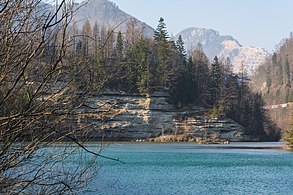
Steyr conglomerate gorge
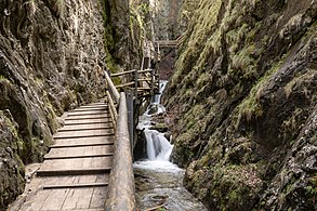
Dr. Vogelgesang Klamm

Wurzeralm

Sengsengebirge seen from the Hofalm


