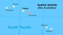
Raivavae (municipality)
Raivavae is a municipality in French Polynesia . It includes the island of the same name among the Austral Islands , which was discovered in 1775 by the Spanish navigator Tomás Gayangos . In 2007 905 inhabitants were counted; the municipality mark covers 16 km². The highest point is Mont Hiro at 437 m. ü. M. Your main town is the sub-municipality of the same name. The entire congregation also includes Anatonu, Rairua-Mahanatoa, and Vaiuru.
Individual evidence
- ^ Institut Statistique de Polynésie Française (ISPF) - Recensement de la population 2007 ( Memento of February 29, 2008 in the Internet Archive ) (PDF; French)
