Rhene
| Rhene | ||
|
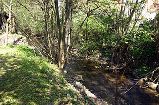
The Rhene in Adorf |
||
| Data | ||
| Water code | EN : 4418 | |
| location | District of Waldeck-Frankenberg ( Hesse ), Hochsauerlandkreis ( North Rhine-Westphalia ), Germany | |
| River system | Weser | |
| Drain over | Diemel → Weser → North Sea | |
| source | in the Upland near Schweinsbühl on the mountain Widdehagen 51 ° 18 ′ 16 ″ N , 8 ° 46 ′ 4 ″ E |
|
| Source height | approx. 550 m above sea level NHN | |
| muzzle | near Padberg in the Diemel coordinates: 51 ° 24 '2 " N , 8 ° 46' 56" E 51 ° 24 '2 " N , 8 ° 46' 56" E |
|
| Mouth height | approx. 301 m above sea level NHN | |
| Height difference | approx. 249 m | |
| Bottom slope | approx. 17 ‰ | |
| length | 15 km | |
| Catchment area | 59.297 km² | |
| Left tributaries | see catchment area and tributaries | |
| Right tributaries | see catchment area and tributaries | |
The Rhene (not to be confused with the nearby, shorter Rhen a ) is an almost 15 km long, right or southern tributary of the Diemel in the Waldeck-Frankenberg district in Hesse and in the Hochsauerlandkreis in North Rhine-Westphalia ( Germany ).
course
The Rhene rises in the north-western part of northern Hesse and in the eastern part of the Upland , the northeastern foothills of the Rothaargebirge . Its source is located around 1.6 km (as the crow flies ) southeast of Schweinsbühl on the southwest slope of the Widdehagen ( 634.7 m above sea level ) in the Diemelsee Nature Park at an altitude of around 550 m .
The Rhene flows in the municipality of Diemelsee - initially east past Schweinsbühl - in a north-northeast direction through Benkhausen to Adorf , to form part of the eastern edge of the Diemelsee nature park and to run north-northwest. In this area it flows past the visitor mine Grube Christiane and then through an increasingly narrow, deeper valley lined with forested mountains.
Finally , after crossing the border with North Rhine-Westphalia , the Rhene flows about 1.1 km (as the crow flies) east-southeast of Padberg - without reaching this Marsberg district - at around 301 m altitude into the Diemel , which comes from there from the southwest .
Catchment area and tributaries
The catchment area of the Rhene, to whose tributaries Aarbach (5.1 km long) and Bicke (5.1 km) belong, covers 59.297 km².
Watershed
The source area of the Rhene lies on the Diemel-Eder / Fulda / Weser watershed . While the Rhen e , which rises on the Widdehagen , drains north over the Diemel into the Weser , the water of the Rhen a , which rises on the neighboring mountain Hohen Rade to the east, flows south over Neerdar and Wilde Aa and then over Orke and Eder to the east to the Fulda and finally to the north to the Weser.
Individual evidence
- ↑ Map services of the Federal Agency for Nature Conservation ( information )
- ↑ Measurement based on the German base map 1: 5000
- ↑ a b Topographical Information Management, Cologne District Government, Department GEObasis NRW ( Notes )
- ↑ a b Water map service of the Hessian Ministry for the Environment, Climate Protection, Agriculture and Consumer Protection ( information )
