Rice Creek, Minnesota
| Rice Creek | ||
|
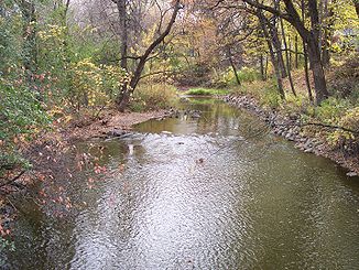
Rice Creek in Fridley, Minnesota |
||
| Data | ||
| location | Minnesota , United States | |
| River system | Mississippi River | |
| Drain over | Mississippi River → Gulf of Mexico | |
| source | Clear Lake in Forest Lake | |
| Source height | 271 m | |
| muzzle |
Mississippi River , Fridley Coordinates: 45 ° 5 ′ 20 " N , 93 ° 16 ′ 44" W 45 ° 5 ′ 20 " N , 93 ° 16 ′ 44" W. |
|
| Mouth height | 246 m | |
| Height difference | 25 m | |
| Bottom slope | 0.56 ‰ | |
| length | 45 km | |
| Catchment area | 521 km² | |
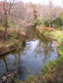
The Rice Creek is a 45 km long tributary of the Mississippi River in the northern suburbs of Minneapolis-Saint Paul in Minnesota in the United States . It drains a catchment area of about 521 km².
Run
Rice Creek originates in Clear Lake within the town of Forest Lake in Washington County and flows generally south through Anoka and Ramsey Counties . It flows through the cities of Columbus , Lino Lakes , Circle Pines , Shoreview , Arden Hills , Mounds View , New Brighton and Fridley . It flows into the Mississippi River within Manomin County Park in Fridley, about 1.5 miles north of the I-694 Mississippi Bridge . The creek has a gradient of 26 m, with the largest part, 20 m, being the last 13 km above the mouth. It rises at a height of 271 m . Its mouth is 246 m .
In Anoka County, Rice Creek flows through an extensive network of small lakes known as the Lino Lakes Chain of Lakes , some of which are a nature reserve administered by the Anoka County Administration. In New Brighton, Rice Creek flows through Long Lake, on the banks of which is Long Lake Regional Park , which is maintained by Ramsey County.
The main tributaries of Rice Creek are Hardwood Creek , which drains an area of 114 km² within the villages of Hugo , Forest Lake and Lino Lakes; and 13.4 km long Clearwater Creek , which drains 161 km² within White Bear Lake , White Bear Township , Hugo, Lino Lakes and Centerville. Both tributaries flow into Rice Creek within the chain of lakes in Anoka County.
history
According to the Minnesota Historical Society , Rice Creek was named after Henry Mower Rice , one of the first two Senators Minnesota sent to the Union after its admission and who acquired extensive land on the lower reaches of the Creek in 1849. The first surveys carried out by Joseph Nicollet recorded the Rice Creek as "Ottonwey River" or Atoonowe-ziibi in the language of the Ojibwe (German roughly "river to make canoes"). However, the name of the water in the language of the Ojibwe was also recorded as Manominiconsepi or Manoominikaan-ziibi , which means "river full of wild rice ". Wild rice originally grew abundantly in the lakes of the catchment area. "Manomin" (wild rice) was also the basis for the naming of the former Manomin County , which was later integrated into Anoka County and partially formed the current city of Fridley, where the creek flows into the Mississippi River.
Archaeological finds suggest that the ancestors of the Sioux began around 2000 BC. Fished and hunted around Bald Eagle Lake (now roughly the area of White Bear Township) and inhabited a summer village that is where Centerville is today.
A group of burial mounds on the north side of Centerville Lake along the watercourse was believed to have been created by members of the Mississippi culture who had been in the area since about 1400.
Catchment area
Rice Creek drains parts of Anoka, Hennepin, Ramsey, and Washington Counties:
- Anoka County - 197 km²
- Hennepin County - <0.2 km²
- Ramsey County - 124 km²
- Washington County - 199 sq km
The following communities and townships are located within the catchment area:
About 10 percent or 49 km² of the catchment area consists of water bodies, of which White Bear Lake with 2140 acres and Bald Eagle Lake with 1046 acres are the largest. Twenty-eight lakes in the area have an area exceeding 100 acres. Around 13 percent or 67 km² of the catchment area consists of wetlands .
See also
Individual evidence
- ↑ a b c d e f g h i Rice Creek Watershed District. Overall Plan, Rice Creek Watershed District. "Prescribed by Minnesota Water Resources Board, December 1975."
- ^ Rice Creek in the Geographic Names Information System of the United States Geological Survey
- ↑ a b c d King's Twin Cities Metro Street Atlas '04. Minneapolis: The Lawrence Group. 2004. ISBN 1-58301-215-X .
- ↑ Anoka County Department of Parks and Recreation: Manomin County Park ( Memento of the original from December 6, 2006 in the Internet Archive ) Info: The archive link was automatically inserted and has not yet been checked. Please check the original and archive link according to the instructions and then remove this notice.
- ↑ Anoka County Department of Parks and Recreation: Rice Creek Chain of Lakes Regional Park Reserve ( Memento of the original from December 6, 2006 in the Internet Archive ) Info: The archive link was automatically inserted and has not yet been checked. Please check the original and archive link according to the instructions and then remove this notice.
- ↑ Ramsey County, Minnesota: Long Lake Regional Park map ( memento of the original from January 20, 2007 in the Internet Archive ) Info: The archive link was automatically inserted and has not yet been checked. Please check the original and archive link according to the instructions and then remove this notice. (PDF; 181 kB)
- ↑ Hardwood Creek in the United States Geological Survey's Geographic Names Information System
- ^ Clearwater Creek in the United States Geological Survey's Geographic Names Information System
- ↑ a b Minnesota Historical Society . Minnesota Place Names. Anoka County: Rice Creek ( Memento of the original from May 17, 2011 in the Internet Archive ) Info: The archive link was inserted automatically and has not yet been checked. Please check the original and archive link according to the instructions and then remove this notice. . Retrieved October 6, 2007.
- ^ Minnesota Historical Society . Minnesota Place Names. Ramsey County: Rice Creek ( Memento of the original from May 17, 2011 in the Internet Archive ) Info: The archive link was automatically inserted and has not yet been checked. Please check the original and archive link according to the instructions and then remove this notice. . Retrieved October 6, 2007.
- ↑ Nicollet, Joseph Nicolas and JC Fremont. Report intended to illustrate a map of the Upper Mississippi River. Washington, DC: Blair and Rives, 1843.
- ^ Durand, Paul C., and Robin Siev Durand. Where the Waters Gather and the Rivers Meet: An Atlas of the Eastern Sioux. Published by the author. Prior Lake, MN: 1994.
- ↑ Koenen, Bruce. Archeology in Minnesota: 2001 Project Report Summaries. ( Memento of the original from September 26, 2006 in the Internet Archive ) Info: The archive link was inserted automatically and has not yet been checked. Please check the original and archive link according to the instructions and then remove this notice. Office of the State Archaeologist. St. Paul: September 2002.
- ↑ Rice Creek Watershed District: District Map ( Memento of the original from July 8, 2006 in the Internet Archive ) Info: The archive link was inserted automatically and has not yet been checked. Please check the original and archive link according to the instructions and then remove this notice.

