
Hennepin County
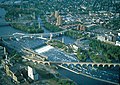
 The Hennepin County Government Center in Minneapolis |
|
| administration | |
|---|---|
| US state : | Minnesota |
| Administrative headquarters : | Minneapolis |
| Address of the administrative headquarters: |
Government Center 300 South 6th Street Minneapolis, MN 55487-0999 |
| Foundation : | March 6, 1852 |
| Made up from: | Dakota County |
| Area code : | 001 612 |
| Demographics | |
| Residents : | 1,152,425 (2010) |
| Population density : | 799.2 inhabitants / km 2 |
| geography | |
| Total area : | 1571 km² |
| Water surface : | 129 km² |
| map | |
 |
|
| Website : www.hennepin.us | |
The Hennepin County is a county in the US -amerikanischen State Minnesota . In 2010 , the county had 1,152,425 residents and a population density of 799.2 people per square kilometer. The county seat is Minneapolis .
Hennepin County is located in the center of the Minneapolis-Saint Paul metropolitan area .
geography
The county is located southeast of the geographic center of Minnesota and is approximately 25 miles east of Wisconsin . It has an area of 1571 square kilometers, of which 129 square kilometers are water.
The largest river in Hennepin County is the Mississippi , which passes the Saint Anthony Falls near downtown Minneapolis . Below the falls, the Mississippi is continuously navigable up to its mouth in Louisiana . The southern and southwestern borders of the county are formed by the Minnesota River , which flows into the Mississippi southeast of Minneapolis at Fort Snelling .
The following neighboring counties border Hennepin County:
| Wright County | Anoka County | |
.svg)
|
Ramsey County | |
| Carver County | Scott County | Dakota County |
history


| Population development | |||
|---|---|---|---|
| Census | Residents | ± in% | |
| 1860 | 12,849 | - | |
| 1870 | 31,566 | 145.7% | |
| 1880 | 67.013 | 112.3% | |
| 1890 | 185.294 | 176.5% | |
| 1900 | 228.340 | 23.2% | |
| 1910 | 333,480 | 46% | |
| 1920 | 415.419 | 24.6% | |
| 1930 | 517.785 | 24.6% | |
| 1940 | 568,899 | 9.9% | |
| 1950 | 676.579 | 18.9% | |
| 1960 | 842.854 | 24.6% | |
| 1970 | 960.080 | 13.9% | |
| 1980 | 941.411 | -1.9% | |
| 1990 | 1,032,431 | 9.7% | |
| 2000 | 1,116,200 | 8.1% | |
| 2010 | 1,152,425 | 3.2% | |
| Before 1900 1900–1990 2000 2010 | |||
Hennepin County was formed on March 6, 1852 from parts of Dakota County. It was named after Louis Hennepin , a Catholic priest and missionary. He was the first European to explore the region and named the Saint Anthony Falls in 1680. The land east of the river came under the administration of England in 1763 and became a territory of the United States after the American War of Independence in 1783. After the Louisiana Purchase in 1803, the west side of the falls also became American. The United States did little to occupy the land until 1819, however, but it wasn't until the following year that Colonel Josiah Snelling established a permanently occupied fort at the mouth of the Minnesota River. The base, initially called Fort Saint Anthony , was later renamed Fort Snelling.
Franklin Steele drew up a land map for the city of Saint Anthony in 1849 . Thanks to the hydropower, the sawmills and grain mills of that time prospered and in 1855 the emerging city already had more than 3,000 inhabitants. The west side of the river was opened for settlement in 1854. The settlement on the west bank of the river was named Minneapolis , a word coined by Charles Hoag . The two cities developed thanks to the industrial and commercial operations and the incorporation of Minneapolis as City took place in 1867. Three years later, Minneapolis and Saint Anthony were merged.
During the 1860s, flour mills began to dominate the Hennepin County's economy. After the Washburn A Mill explosion on May 2, 1878, the owners quickly rebuilt the mill to make it bigger. Their competition, Charles A. Pillsbury and Company, began building Pillsbury A Mill on the east side of the falls around the same time . By 1900, Minneapolis mills were processing around 14.1 percent of the world's grain.
Historical objects
Saint Anthony Falls

Cedar Avenue Bridge

Fort Snelling

Washburn Park Water Tower


One place in Hennepin County has the status of a National Historic Landmark , Fort Snelling . A total of 150 buildings and sites in the county are registered on the National Register of Historic Places (as of January 28, 2018).
Demographic data
According to the 2010 census , Hennepin County had 1,152,425 people in 475,737 households. The population density was 799.2 inhabitants per square kilometer. Statistically, 2.36 people lived in each of the 475,737 households.
The racial the population was composed of 77.3 percent white, 12.0 percent African American, 1.2 percent Native American, 6.5 percent Asian, 0.1 percent Polynesian and other ethnic groups; 3.0 percent were descended from two or more races. Hispanic or Latino of any race was 6.9 percent of the population.
22.6 percent of the population were under 18 years old, 65.9 percent were between 18 and 64 and 11.5 percent were 65 years or older. 50.8 percent of the population was female.
The median income for a household was 62,966 USD . The per capita income was $ 36,858. 12.3 percent of the population lived below the poverty line.
Villages in Hennepin County
All settlements in Hennepin County have the status " City ":
1 - mostly in Carver County
2 - partly in Wright County
3 - partly in Ramsey County
structure
The county is almost entirely part of the 45 cities due to its high population density. Only around Fort Snelling is an unorganized territory with 149 inhabitants.
See also
Individual evidence
- ↑ GNIS-ID: 659472. Retrieved on February 22, 2011 (English).
- ↑ a b c U.S. Census Bureau, State & County QuickFacts - Hennepin County, MN ( July 11, 2011 memento on WebCite ) Retrieved January 30, 2013
- ↑ a b National Association of Counties.Retrieved January 30, 2013
- ^ US Census Bureau _ Census of Population and Housing.Retrieved February 17, 2011
- ↑ Extract from Census.gov.Retrieved February 17, 2011
- ↑ a b Lucile M. Kane: The Falls of St. Anthony: The Waterfall That Built Minneapolis . Minnesota Historical Society , St. Paul , Minnesota 1966, revised 1987.
- ↑ Anfinson, John O .: Spiritual Power to Industrial Might: 12,000 Years at St. Anthony Falls . In: Minnesota History . 58, No. 5, ISSN 0026-5497 , pp. 252-269.
- ↑ Danbom, David B. : Flour Power: The Significance of Flour Milling at the Falls . In: Minnesota History . 58, No. 5, ISSN 0026-5497 , pp. 271-285.
- ↑ Listing of National Historic Landmarks by State: Minnesota . National Park Service , accessed January 28, 2018.
- ↑ Search mask database in the National Register Information System. National Park Service , accessed January 28, 2018.
Web links
List of counties in Minnesota
Aitkin |
Anoka |
Becker |
Beltrami |
Benton |
Big Stone |
Blue Earth |
Brown |
Carlton |
Carver |
Cass |
Chippewa |
Chisago |
Clay |
Clearwater |
Cook |
Cottonwood |
Crow Wing |
Dakota |
Dodge |
Douglas |
Faribault |
Fillmore |
Freeborn |
Goodhue |
Grant |
Hennepin |
Houston |
Hubbard |
Isanti |
Itasca |
Jackson |
Kanabec |
Kandiyohi |
Kittson |
Koochiching |
Lac qui Parle |
Lake |
Lake of the Woods |
Le Sueur |
Lincoln |
Lyon |
Reminders |
Marshall |
Martin |
McLeod |
Meeker |
Mille Lacs |
Morrison |
Mower |
Murray |
Nicollet |
Nobles |
Norman |
Olmsted |
Otter Tail |
Pennington |
Pine |
Pipestone |
Polk |
Pope |
Ramsey |
Red Lake |
Redwood |
Renville |
Rice |
Skirt |
Roseau |
Scott |
Sherburne |
Sibley |
St. Louis |
Stearns |
Steele |
Stevens |
Swift |
Todd |
Traverse |
Wabasha |
Wadena |
Waseca |
Washington |
Watonwan |
Wilkin |
Winona |
Wright |
Yellow Medicine
Coordinates: 45 ° 0 ′ N , 93 ° 28 ′ W