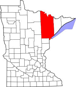
St. Louis County, Minnesota
![The St. Louis County Courthouse in Duluth, listed in the NRHP since 1992 [1]](https://upload.wikimedia.org/wikipedia/commons/thumb/3/3e/SLCCH.jpg/298px-SLCCH.jpg) The St. Louis County Courthouse in Duluth, listed on the NRHP since 1992 |
|
| administration | |
|---|---|
| US state : | Minnesota |
| Administrative headquarters : | |
| Address of the administrative headquarters: |
County Courthouse 100 N 5th Avenue West Duluth, MN 55802-1201 |
| Foundation : | March 1, 1856 |
| Made up from: |
Itasca County Newton County |
| Area code : | 001 218 |
| Demographics | |
| Residents : | 200,226 (2010) |
| Population density : | 12.4 inhabitants / km 2 |
| geography | |
| Total area : | 17,767 km² |
| Water surface : | 1644 km² |
| map | |
| Website : www.stlouiscountymn.gov | |
The St. Louis County is the geographically largest county in US -amerikanischen State Minnesota . In 2010 the county had a population of 200,226 people and a population density of 12.4 people per square kilometer. The county seat is Duluth .
geography
The county is located in northeast Minnesota, borders Canada to the north and Lake Superior , one of the Great Lakes, and Wisconsin to the southeast . St. Louis County covers an area of 17,767 square kilometers, of which 1,644 square kilometers are water. The following neighboring counties and districts border St. Louis County:
| Koochiching County |
Rainy River District ( Ontario , Canada ) |
|
| Itasca County |

|
Lake County |
| Aitkin County | Carlton County |
Douglas County, Wisconsin |
history
St. Louis County was formed on March 1, 1856 from parts of Itasca County and the no longer existing Newton County. It was named after the St. Louis River .
Four locations in Pine County have National Historic Landmark status , including three mines and a lighthouse. A total of 120 buildings and sites in the county are registered on the National Register of Historic Places (as of January 31, 2018).
Demographic data
| Population development | |||
|---|---|---|---|
| Census | Residents | ± in% | |
| 1860 | 406 | - | |
| 1870 | 4561 | 1,023.4% | |
| 1880 | 4504 | -1.2% | |
| 1890 | 44,862 | 896% | |
| 1900 | 82,932 | 84.9% | |
| 1910 | 163.274 | 96.9% | |
| 1920 | 206.391 | 26.4% | |
| 1930 | 204,596 | -0.9% | |
| 1940 | 206.917 | 1.1% | |
| 1950 | 206.062 | -0.4% | |
| 1960 | 231,588 | 12.4% | |
| 1970 | 220,693 | -4.7% | |
| 1980 | 222.229 | 0.7% | |
| 1990 | 198.213 | -10.8% | |
| 2000 | 200,528 | 1.2% | |
| 2010 | 200.226 | -0.2% | |
| Before 1900 1900–1990 2000 2010 | |||

According to the 2010 census , St. Louis County had 200,226 people in 86,446 households. The population density was 12.4 inhabitants per square kilometer. Statistically, 2.2 people lived in each of the 86,446 households.
The racial the population was composed of 93.0 percent white, 1.5 percent African American, 2.3 percent Native American, 1.5 percent Asian and other ethnic groups; 2.2 percent were descended from two or more races. Hispanic or Latino of any race was 1.3 percent of the population, regardless of ethnicity.
19.4 percent of the population were under 18 years old, 64.6 percent were between 18 and 64 and 16.0 percent were 65 years or older. 49.9 percent of the population was female.
The median income for a household was 45,399 USD . The per capita income was $ 25,586. 16.0 percent of the population lived below the poverty line.
St. Louis County localities
Census-designated places (CDP)
Other Unincorporated Communities
2 - partly in Itasca County
structure
In addition to the 26 cities, St. Louis County is divided into 73 townships (TS) and twelve unorganized territories (UT):
|
|
|
|
See also
Individual evidence
- ↑ Extract from the National Register of Historic Places - No. 92000798. Retrieved August 9, 2011
- ↑ St. Louis County ( English ) In: Geographic Names Information System . United States Geological Survey . Retrieved February 22, 2011.
- ↑ a b c U.S. Census Bureau, State & County QuickFacts - St. Louis County, MN Retrieved June 21, 2013
- ↑ a b National Association of Counties.Retrieved June 21, 2013
- ↑ Listing of National Historic Landmarks by State: Minnesota . National Park Service , accessed January 31, 2018.
- ↑ Search mask database in the National Register Information System. National Park Service , accessed January 31, 2018.
- ^ US Census Bureau _ Census of Population and Housing.Retrieved February 17, 2011
- ↑ Extract from Census.gov.Retrieved February 17, 2011
- ^ Census 2010 - Minnesota , Retrieved May 5, 2020
Web links
Coordinates: 47 ° 35 ′ N , 92 ° 28 ′ W

