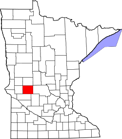
Pope County, Minnesota
![Pope County Courthouse, listed on the NRHP since 1982 [1]](https://upload.wikimedia.org/wikipedia/commons/thumb/d/d0/2013-0408-PopeCtyCourthouse.jpg/298px-2013-0408-PopeCtyCourthouse.jpg) Pope County Courthouse, listed on the NRHP since 1982 |
|
| administration | |
|---|---|
| US state : | Minnesota |
| Administrative headquarters : | Glenwood |
| Address of the administrative headquarters: |
County Courthouse 130 E. Minnesota Ave. Glenwood, MN 56334-9253 |
| Foundation : | February 20, 1862 |
| Made up from: |
Cass County Pierce County |
| Area code : | 001 320 |
| Demographics | |
| Residents : | 10,995 (2010) |
| Population density : | 6.3 inhabitants / km 2 |
| geography | |
| Total area : | 1858 km² |
| Water surface : | 122 km² |
| map | |
| Website : www.co.pope.mn.us | |
The Pope County is a county in the US -amerikanischen State Minnesota . In 2010 , the county had 10,995 residents and a population density of 6.3 people per square kilometer. The county seat is Glenwood .
geography
The county is located in west-central Minnesota and is traversed in a north-south direction by the Chippewa River , a left tributary of the Minnesota River . It has an area of 1858 square kilometers, of which 122 square kilometers are water.
In the center of Pope County is Glacial Lakes State Park , an approximately eight square kilometers state park with landscape shaped by the Ice Age.
The following neighboring counties border Pope County:
| Grant County | Douglas County | |
| Stevens County |

|
Stearns County |
| Swift County | Kandiyohi County |
history
Pope County was formed on February 20, 1862 from parts of Cass County and Pierce County, which now only exists in Wisconsin. It was named after John Pope (1822-1892), a general in the Union Forces in the American Civil War .
Demographic data
| Population development | |||
|---|---|---|---|
| Census | Residents | ± in% | |
| 1870 | 2691 | - | |
| 1880 | 5874 | 118.3% | |
| 1890 | 10,032 | 70.8% | |
| 1900 | 12,577 | 25.4% | |
| 1910 | 12,746 | 1.3% | |
| 1920 | 13,631 | 6.9% | |
| 1930 | 13,085 | -4% | |
| 1940 | 13,544 | 3.5% | |
| 1950 | 12,862 | -5% | |
| 1960 | 11,914 | -7.4% | |
| 1970 | 11,107 | -6.8% | |
| 1980 | 11,657 | 5% | |
| 1990 | 10,745 | -7.8% | |
| 2000 | 11,236 | 4.6% | |
| 2010 | 10,995 | -2.1% | |
| Before 1900 1900–1990 2000 2010 | |||
According to the 2010 census , Pope County had 10,995 people in 4,823 households. The population density was 6.3 people per square kilometer. Statistically, 2.24 people lived in each of the 4823 households.
The racial the population was composed of 98.1 percent white, 0.4 percent African American, 0.2 percent Native American, 0.4 percent Asian and other ethnic groups; 0.9 percent were descended from two or more races. Hispanic or Latino of any race was 1.0 percent of the population.
20.7 percent of the population were under 18 years old, 57.8 percent were between 18 and 64 and 21.5 percent were 65 years or older. 49.5 percent of the population was female.
The median income for a household was 49,599 USD . The per capita income was $ 27,727. 7.6 percent of the population lived below the poverty line.
Pope County localities
1 - partially in Stearns County
structure
In addition to the ten cities, Pope County is divided into 20 townships :
|
|
See also
Individual evidence
- ↑ Extract from the National Register of Historic Places - No. 82002997.Retrieved June 11, 2013
- ↑ GNIS-ID: 659506. Retrieved on February 22, 2011 (English).
- ↑ a b c U.S. Census Bureau, State & County QuickFacts - Pope County, MN Retrieved June 11, 2013
- ↑ a b National Association of Counties. Retrieved June 11, 2013
- ^ US Census Bureau - Census of Population and Housing.Retrieved March 15, 2011
- ^ Extract from Census.gov.Retrieved February 18, 2011
- ^ Census 2010 - Minnesota , Retrieved May 5, 2020
Web links
Coordinates: 45 ° 35 ′ N , 95 ° 27 ′ W


