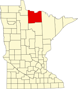
Koochiching County
![The Koochiching County Courthouse in International Falls, listed in the NRHP since 1977 [1]](https://upload.wikimedia.org/wikipedia/commons/thumb/2/2e/KOOCHICHING_COUNTY_COURTHOUSE.jpg/298px-KOOCHICHING_COUNTY_COURTHOUSE.jpg) The Koochiching County Courthouse in International Falls, listed on the NRHP since 1977 |
|
| administration | |
|---|---|
| US state : | Minnesota |
| Administrative headquarters : | International Falls |
| Address of the administrative headquarters: |
County Courthouse 715 4th Street International Falls, MN 56649-2438 |
| Foundation : | December 19, 1906 |
| Made up from: | Itasca County |
| Area code : | 001 218 |
| Demographics | |
| Residents : | 13,311 (2010) |
| Population density : | 1.7 inhabitants / km 2 |
| geography | |
| Total area : | 8170 km² |
| Water surface : | 135 km² |
| map | |
| Website : www.co.koochiching.mn.us | |
The Koochiching County is a county in the US -amerikanischen State Minnesota . In 2010 , the county had 13,311 residents and a population density of 1.7 people per square kilometer. The county seat is International Falls , named after its location at Koochiching Falls on the border with Canada.
Part of the Bois Forte Reservation is in Koochiching County.
geography
The county is located in northern Minnesota and is separated from Canada by Rainy Lake and its drain, the Rainy River . It has an area of 8170 square kilometers, of which 135 square kilometers are water. Koochiching County is bordered by the following counties and districts:
| Lake of the Woods County |
Rainy River District ( Ontario , Canada ) |
|

|
St. Louis County | |
| Beltrami County | Itasca County |
history
Koochiching County was formed on December 19, 1906 from parts of Itasca County. It was named after the Indian expression for the Rainy River.
One place in Koochiching County has the status of a National Historic Landmark , the small town of Grand Mound . Twelve buildings and sites in the county are listed in the National Register of Historic Places (as of January 29, 2018).
Demographic data
| Population development | |||
|---|---|---|---|
| Census | Residents | ± in% | |
| 1910 | 6431 | - | |
| 1920 | 13,520 | 110.2% | |
| 1930 | 14,078 | 4.1% | |
| 1940 | 16,930 | 20.3% | |
| 1950 | 16,910 | -0.1% | |
| 1960 | 18,190 | 7.6% | |
| 1970 | 17.131 | -5.8% | |
| 1980 | 17,571 | 2.6% | |
| 1990 | 16,299 | -7.2% | |
| 2000 | 14,355 | -11.9% | |
| 2010 | 13,311 | -7.3% | |
| 1900–1990 2000 2010 | |||
According to the 2010 census , Koochiching County had 13,311 people in 6194 households. The population density was 1.7 people per square kilometer. Statistically, 2.11 people lived in each of the 6194 households.
The racial the population was composed of 94.6 percent white, 0.8 percent African American, 2.4 percent Native American, 0.4 percent Asian and other ethnic groups; 1.7 percent were descended from two or more races. Hispanic or Latino of any race was 1.2 percent of the population.
20.7 percent of the population were under 18 years old, 59.8 percent were between 18 and 64 and 19.5 percent were 65 years or older. 50.0 percent of the population was female.
The median income for a household was 41,135 USD . The per capita income was $ 24,829. 12.6 percent of the population lived below the poverty line.
Localities in Koochiching County
structure
In addition to the six cities, Koochiching County consists of six Unorganized Territories (UT):
| UT | Population (2010) |
FIPS |
|---|---|---|
| East Koochiching UT | 355 | 27-17660 |
| Nice Lake UT | 101 | 27-45277 |
| Northome UT | 447 | 27-47131 |
| Northwest Koochiching UT | 463 | 27-47352 |
| Rainy Lake UT | 4048 | 27-52990 |
| South Koochiching UT | 189 | 27-61433 |
See also
Individual evidence
- ↑ Extract from the National Register of Historic Places - No. 77000749.Retrieved May 5, 2013
- ↑ GNIS-ID: 659481. Retrieved on February 22, 2011 (English).
- ↑ a b c U.S. Census Bureau, State & County QuickFacts - Koochiching County, MN ( July 13, 2011 memento on WebCite ) Retrieved May 5, 2013
- ↑ a b National Association of Counties.Retrieved May 5, 2013
- ↑ Listing of National Historic Landmarks by State: Minnesota . National Park Service , accessed January 29, 2018.
- ↑ Search mask database in the National Register Information System. National Park Service , accessed January 29, 2018.
- ↑ Extract from Census.gov.Retrieved February 17, 2011
- ^ Census 2010 - Minnesota , Retrieved May 5, 2020
Web links
Coordinates: 48 ° 16 ′ N , 93 ° 46 ′ W
