Lake of the Woods County
| administration | |
|---|---|
| US state : | Minnesota |
| Administrative headquarters : | Baudette |
| Address of the administrative headquarters: |
County Courthouse 206 SE 8th Avenue Baudette, MN 56623-0000 |
| Foundation : | November 28, 1922 |
| Made up from: | Beltrami County |
| Area code : | 001 218 |
| Demographics | |
| Residents : | 4045 (2010) |
| Population density : | 1.2 inhabitants / km 2 |
| geography | |
| Total area : | 4597 km² |
| Water surface : | 1239 km² |
| map | |
| Website : www.co.lake-of-the-woods.mn.us | |
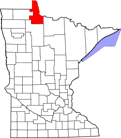
The Lake of the Woods County is a county in the US -amerikanischen State Minnesota . In 2010 the county had 4,045 residents and a population density of 1.2 people per square kilometer. The county seat is Baudette .
Parts of the Red Lake Reservation of the Ojibwe lie across Lake of the Woods County .
geography
The county is located in the far north of Minnesota on the Lake of the Woods and the Rainy River that flows into it and forms the border with Canada . It has an area of 4597 square kilometers, of which 1239 square kilometers are water. The county includes the so-called Northwest Angle , the only part of the USA outside of Alaska that is north of the 49th parallel. Since Alaska has no counties, Lake of the Woods County is the northernmost county in the United States. The following neighboring counties and districts border Lake of the Woods County:
|
Manitoba Province ( Canada ) |
Kenora District ( Ontario , Canada ) |
|
| Roseau County |

|
Rainy River District , ( Ontario , Canada ) |
| Beltrami County | Koochiching County |
history
The Lake of the Woods County was formed on November 28, 1922 from parts of Beltrami County. It was named after the Lake of the Woods , which is the northern border.
Demographic data
| Population development | |||
|---|---|---|---|
| Census | Residents | ± in% | |
| 1930 | 4194 | - | |
| 1940 | 5975 | 42.5% | |
| 1950 | 4955 | -17.1% | |
| 1960 | 4304 | -13.1% | |
| 1970 | 3987 | -7.4% | |
| 1980 | 3764 | -5.6% | |
| 1990 | 4076 | 8.3% | |
| 2000 | 4522 | 10.9% | |
| 2010 | 4045 | -10.5% | |
| 1900–1990 2000 2010 | |||
According to the 2010 census , the Lake of the Woods County had 4,045 people in 1,728 households. The population density was 1.2 inhabitants per square kilometer. Statistically, 2.35 people lived in 1728 households.
The racial the population was composed of 96.0 percent white, 0.4 percent African American, 0.7 percent Native American, 0.8 percent Asian and other ethnic groups; 2.0 percent were descended from two or more races. Hispanic or Latino of any race was 1.2 percent of the population.
19.7 percent of the population were under 18 years old, 60.1 percent were between 18 and 64 and 20.2 percent were 65 years or older. 48.9 percent of the population was female.
The median income for a household was 43,523 USD . The per capita income was $ 25,999. 15.9 percent of the population lived below the poverty line.
Localities in the Lake of the Woods County
Other Unincorporated Communities
1 - partially in Roseau County
structure
The Lake of the Woods County is divided into 23 townships in addition to the three cities :
|
|
|
See also
Individual evidence
- ↑ GNIS-ID: 659483. Retrieved on February 22, 2011 (English).
- ↑ a b c U.S. Census Bureau, State & County QuickFacts - Lake of the Woods County, MN ( July 13, 2011 memento on WebCite ) Retrieved May 10, 2013
- ↑ a b National Association of Counties.Retrieved May 10, 2013
- ↑ Extract from Census.gov.Retrieved February 17, 2011
- ^ Census 2010 - Minnesota , Retrieved May 5, 2020
Web links
Coordinates: 48 ° 46 ' N , 94 ° 54' W
