
Mower County
 The Mower County Courthouse in Austin |
|
| administration | |
|---|---|
| US state : | Minnesota |
| Administrative headquarters : | Austin |
| Address of the administrative headquarters: |
County Courthouse 201 1st Street, NE Austin, MN 55912-3405 |
| Foundation : | February 20, 1855 |
| Made up from: | Rice County |
| Area code : | 001 507 |
| Demographics | |
| Residents : | 39,163 (2010) |
| Population density : | 21.3 inhabitants / km 2 |
| geography | |
| Total area : | 1843 km² |
| Water surface : | 1 km² |
| map | |
 |
|
| Website : www.co.mower.mn.us | |
The Mower County is a county in the US -amerikanischen State Minnesota . In 2010 , the county had 39,163 people and a population density of 21.3 people per square kilometer. The county seat is Austin .
geography

The county is located in southeast Minnesota and borders Iowa . It has an area of 1843 square kilometers, of which one square kilometer is water. The county is traversed from north to south by the Cedar River , a tributary of the Iowa River that flows into the Mississippi . The following neighboring counties border Mower County:
| Steele County | Dodge County | Olmsted County |
| Freeborn County |
.svg)
|
Fillmore County |
|
Worth County, Iowa |
Mitchell County, Iowa |
Howard County, Iowa |
history
| Population development | |||
|---|---|---|---|
| Census | Residents | ± in% | |
| 1860 | 3217 | - | |
| 1870 | 10,447 | 224.7% | |
| 1880 | 16,799 | 60.8% | |
| 1890 | 18,019 | 7.3% | |
| 1900 | 22,335 | 24% | |
| 1910 | 22,640 | 1.4% | |
| 1920 | 25,993 | 14.8% | |
| 1930 | 28,065 | 8th % | |
| 1940 | 36,113 | 28.7% | |
| 1950 | 42,277 | 17.1% | |
| 1960 | 48,498 | 14.7% | |
| 1970 | 43,783 | -9.7% | |
| 1980 | 40,390 | -7.7% | |
| 1990 | 37,385 | -7.4% | |
| 2000 | 38,603 | 3.3% | |
| 2010 | 39.163 | 1.5% | |
| Before 1900 1900–1990 2000 2010 | |||
Mower County was formed on February 20, 1855 from parts of Rice County. It was named after John Edward Mower (1815-1879), a member of the Board of Minnesota - territory in the 1850s.
Historical objects

LeRoy Public Library
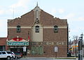
Paramount Theater in Austin


Other historical objects:
Demographic data
According to the 2010 census , Mower County had 39,163 people in 16,042 households. The population density was 21.3 people per square kilometer. Statistically, there were 2.39 people each in the 16,042 households.
The racial the population was composed of 93.6 percent white, 2.6 percent African American, 0.4 percent Native American, 1.9 percent Asian, 0.2 percent Polynesian and other ethnic groups; 1.3 percent were descended from two or more races. Hispanic or Latino of any race was 11.0 percent of the population regardless of ethnicity.
25.4 percent of the population were under 18 years old, 57.6 percent were between 18 and 64 and 17.0 percent were 65 years or older. 50.1 percent of the population was female.
The median income for a household was 45,596 USD . The per capita income was $ 24,170. 15.3 percent of the population lived below the poverty line.
Towns in Mower County
Other Unincorporated Communities
1 - partially in Freeborn County
structure
In addition to the 14 cities, Mower County is divided into 20 townships :
|
|
Individual evidence
- ↑ GNIS-ID: 659495. Retrieved on February 22, 2011 (English).
- ↑ a b c U.S. Census Bureau, State & County QuickFacts - Mower County, MN ( July 15, 2011 memento on WebCite ) Retrieved January 25, 2013
- ↑ a b National Association of Counties.Retrieved January 25, 2013
- ^ US Census Bureau - Census of Population and Housing.Retrieved March 15, 2011
- ^ Extract from Census.gov.Retrieved February 18, 2011
- ^ Census 2010 - Minnesota , Retrieved May 5, 2020
Web links
List of counties in Minnesota
Aitkin |
Anoka |
Becker |
Beltrami |
Benton |
Big Stone |
Blue Earth |
Brown |
Carlton |
Carver |
Cass |
Chippewa |
Chisago |
Clay |
Clearwater |
Cook |
Cottonwood |
Crow Wing |
Dakota |
Dodge |
Douglas |
Faribault |
Fillmore |
Freeborn |
Goodhue |
Grant |
Hennepin |
Houston |
Hubbard |
Isanti |
Itasca |
Jackson |
Kanabec |
Kandiyohi |
Kittson |
Koochiching |
Lac qui Parle |
Lake |
Lake of the Woods |
Le Sueur |
Lincoln |
Lyon |
Reminders |
Marshall |
Martin |
McLeod |
Meeker |
Mille Lacs |
Morrison |
Mower |
Murray |
Nicollet |
Nobles |
Norman |
Olmsted |
Otter Tail |
Pennington |
Pine |
Pipestone |
Polk |
Pope |
Ramsey |
Red Lake |
Redwood |
Renville |
Rice |
Skirt |
Roseau |
Scott |
Sherburne |
Sibley |
St. Louis |
Stearns |
Steele |
Stevens |
Swift |
Todd |
Traverse |
Wabasha |
Wadena |
Waseca |
Washington |
Watonwan |
Wilkin |
Winona |
Wright |
Yellow Medicine
Coordinates: 43 ° 40 ′ N , 92 ° 45 ′ W