Goodhue County
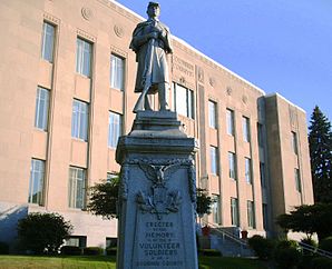
 Goodhue County Courthouse |
|
| administration | |
|---|---|
| US state : | Minnesota |
| Administrative headquarters : | Red Wing |
| Address of the administrative headquarters: |
Justice Center / Court Administration 454 W. 6th Street Red Wing, MN 55066-2540 |
| Foundation : | March 3, 1853 |
| Made up from: |
Dakota County Wabasha County |
| Area code : | 001 651 |
| Demographics | |
| Residents : | 46,183 (2010) |
| Population density : | 23.5 inhabitants / km 2 |
| geography | |
| Total area : | 2021 km² |
| Water surface : | 57 km² |
| map | |
| Website : www.co.goodhue.mn.us | |
The Goodhue County is a county in the US -amerikanischen State Minnesota . In 2010 the county had 46,183 residents and a population density of 23.5 people per square kilometer. The county seat is Red Wing , which was named after a Dakota chief.
geography
The county is located in southeast Minnesota on the right bank of the Mississippi , which forms the border with Wisconsin . It has an area of 2021 square kilometers, of which 57 square kilometers are water. The following neighboring counties border Goodhue County:
| Dakota County |
Pierce County, Wisconsin , Pepin County, Wisconsin |
|
| Rice County |

|
Wabasha County |
| Steele County | Dodge County | Olmsted County |
history
Goodhue County was formed on March 3, 1853 from parts of Dakota County and Wabasha County. It was named after James Madison Goodhue , the editor of a newspaper.
64 buildings and sites in the county are listed on the National Register of Historic Places (as of January 28, 2018).
Demographic data
| Population development | |||
|---|---|---|---|
| Census | Residents | ± in% | |
| 1860 | 8977 | - | |
| 1870 | 22,618 | 152% | |
| 1880 | 29,651 | 31.1% | |
| 1890 | 28,806 | -2.8% | |
| 1900 | 31,137 | 8.1% | |
| 1910 | 31,637 | 1.6% | |
| 1920 | 30,799 | -2.6% | |
| 1930 | 31,317 | 1.7% | |
| 1940 | 31,564 | 0.8% | |
| 1950 | 32,118 | 1.8% | |
| 1960 | 33,035 | 2.9% | |
| 1970 | 34,763 | 5.2% | |
| 1980 | 38,749 | 11.5% | |
| 1990 | 40,690 | 5% | |
| 2000 | 44,127 | 8.4% | |
| 2010 | 46.183 | 4.7% | |
| Before 1900 1900–1990 2000 2010 | |||

As of the 2010 census , Goodhue County had 46,183 people in 18,686 households. The population density was 23.5 inhabitants per square kilometer. Statistically, 2.41 people lived in the 18,686 households.
The racial the population was composed of 95.5 percent white, 1.1 percent African American, 1.3 percent Native American, 0.6 percent Asian, 0.1 percent Polynesian and other ethnic groups; 1.4 percent were descended from two or more races. Hispanic or Latino of any race was 3.1 percent of the population.
23.3 percent of the population were under 18 years old, 59.8 percent were between 18 and 64 and 16.9 percent were 65 years or older. 50.3 percent of the population was female.
The median income for a household was 56,099 USD . The per capita income was $ 27,996. 8.2 percent of the population lived below the poverty line.
Goodhue County localities
Other Unincorporated Communities
1 - partly in Wabasha County
2 - partly in Rice County
3 - partly in Olmsted County
structure
In addition to the ten cities, Goodhue County is divided into 21 townships :
|
|
|
See also
Individual evidence
- ↑ GNIS-ID: 659470. Retrieved on February 22, 2011 (English).
- ↑ a b c U.S. Census Bureau, State & County QuickFacts - Goodhue County, MN ( July 10, 2011 memento on WebCite ) Retrieved February 4, 2013
- ↑ a b National Association of Counties.Retrieved February 4, 2013
- ↑ Search mask database in the National Register Information System. National Park Service , accessed January 28, 2018.
- ^ US Census Bureau - Census of Population and Housing.Retrieved March 15, 2011
- ^ Extract from Census.gov.Retrieved February 18, 2011
- ^ Census 2010 - Minnesota , Retrieved May 5, 2020
Web links
Coordinates: 44 ° 25 ′ N , 92 ° 43 ′ W

