Pepin County
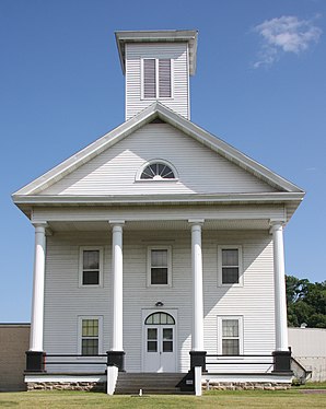
 former Pepin County Courthouse |
|
| administration | |
|---|---|
| US state : | Wisconsin |
| Administrative headquarters : | Durand |
| Address of the administrative headquarters: |
County Courthouse 740, 7th Avenue West Durand, WI 54736-0039 |
| Foundation : | 1858 |
| Made up from: | Dunn County |
| Area code : | 001 715 |
| Demographics | |
| Residents : | 7469 (2010) |
| Population density : | 12.4 inhabitants / km 2 |
| geography | |
| Total area : | 644 km² |
| Water surface : | 42 km² |
| map | |
| Website : www.co.pepin.wi.us | |
The Pepin County is a county in the US -amerikanischen State Wisconsin . In 2010 , the county had 7,469 people and a population density of 12.4 people per square kilometer. By 2013 the population had decreased to 7,360. The county seat is Durand , named after Miles Durand Prindle , an early settler in the area.
geography
The county is located in western Wisconsin at the confluence of the Chippewa River with the Mississippi , which forms the border with Minnesota . It has an area of 644 square kilometers, of which 42 square kilometers are water. The following neighboring counties border Pepin County:
| Pierce County | Dunn County | |
|
Goodhue County, Minnesota |

|
Eau Claire County |
|
Wabasha County, Minnesota |
Buffalo County |
history
| Population development | |||
|---|---|---|---|
| Census | Residents | ± in% | |
| 1900 | 7905 | - | |
| 1910 | 7577 | -4.1% | |
| 1920 | 7481 | -1.3% | |
| 1930 | 7450 | -0.4% | |
| 1940 | 7897 | 6% | |
| 1950 | 7462 | -5.5% | |
| 1960 | 7332 | -1.7% | |
| 1970 | 7319 | -0.2% | |
| 1980 | 7477 | 2.2% | |
| 1990 | 7107 | -4.9% | |
| 2000 | 7213 | 1.5% | |
| 2010 | 7469 | 3.5% | |
| 2013 estimate | 7360 | -1.5% | |
| 1900–1990 2000 2010–2013 | |||
Pepin County was formed in 1858 from parts of Dunn County. It was named after the French conquerors Pierre and Jean Pepin du Chardonnets .
population
According to the 2010 census , Pepin County had 7,469 people in 3,017 households. The population density was 12.4 inhabitants per square kilometer. Statistically, there were 2.43 people each in the 3,017 households.
The racial the population was composed of 98.1 percent white, 0.5 percent African American, 0.3 percent Native American, 0.3 percent Asian and other ethnic groups; 0.7 percent were descended from two or more races. Regardless of ethnicity, 1.5 percent of the population was Hispanic or Latino of any race.
22.4 percent of the population were under 18 years old, 57.5 percent were between 18 and 64 and 20.1 percent were 65 years or older. 49.5 percent of the population were female.
The median income for a household was 49,544 USD . The per capita income was $ 24,436. 10.5 percent of the population lived below the poverty line.
Localities in Pepin County
Other Unincorporated Communities
1 - partially in Pierce County
structure
Pepin County is divided into eight towns :
| Town | Population (2010) |
FIPS |
|---|---|---|
| Town of Albany | 676 | 55-00800 |
| Town of Durand | 742 | 55-21250 |
| Town of Frankfort | 343 | 55-27175 |
| Town of Lima | 702 | 55-44075 |
| Town of Pepin | 721 | 55-61950 |
| Town of Stockholm | 197 | 55-77500 |
| Town of Waterville | 831 | 55-84025 |
| Town of Waubeek | 423 | 55-84100 |
See also
Individual evidence
- ^ Pepin County in the United States Geological Survey's Geographic Names Information System.Retrieved February 22, 2011
- ↑ a b c d U.S. Census Bureau, State & County QuickFacts - Pepin County, WI ( Memento of the original from July 16, 2011 on WebCite ) Info: The archive link was automatically inserted and has not yet been checked. Please check the original and archive link according to the instructions and then remove this notice. Retrieved August 5, 2014
- ↑ a b National Association of Counties.Retrieved August 5, 2014
- ↑ Extract from Census.gov.Retrieved August 5, 2014
- ↑ Missouri Census Data Center - Wisconsin ( Memento of the original from January 18, 2016 in the Internet Archive ) Info: The archive link was inserted automatically and has not yet been checked. Please check the original and archive link according to the instructions and then remove this notice. Retrieved August 5, 2014
Web links
Coordinates: 44 ° 36 ' N , 92 ° 0' W
