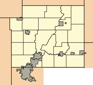
Chippewa County, Wisconsin
 Chippewa County Courthouse |
|
| administration | |
|---|---|
| US state : | Wisconsin |
| Administrative headquarters : | Chippewa Falls |
| Address of the administrative headquarters: |
County Courthouse 711 N Bridge Street Chippewa Falls, WI 54729-1802 |
| Foundation : | 1845 |
| Made up from: | Crawford County |
| Area code : | 001 715 |
| Demographics | |
| Residents : | 62,415 (2010) |
| Population density : | 23.8 inhabitants / km 2 |
| geography | |
| Total area : | 2697 km² |
| Water surface : | 80 km² |
| map | |
| Website : www.co.chippewa.wi.us | |
Chippewa County is a county in the US -amerikanischen State Wisconsin . In 2010 the county had 62,415 residents and a population density of 23.8 people per square kilometer. By 2012 the population increased to 62,922. The county seat is Chippewa Falls .
Chippewa County is part of the Eau Claire – Chippewa Falls metropolitan area .
geography
The county is located in central northwest Wisconsin and has an area of 2,697 square kilometers, of which 80 square kilometers are water.
The Chippewa River , a left tributary of the Mississippi, flows through the county from northeast to southwest . In the south of the county, the Chippewa River is dammed up to form the 2,438 hectare Lake Wissota , on the east bank of which Lake Wissota State Park is located.
The following neighboring counties border Chippewa County:
| Barron County | Rusk County | |
| Dunn County |

|
Taylor County |
| Eau Claire County | Clark County |
history
| Population development | |||
|---|---|---|---|
| Census | Residents | ± in% | |
| 1900 | 33,037 | - | |
| 1910 | 32,103 | -2.8% | |
| 1920 | 36,482 | 13.6% | |
| 1930 | 37,342 | 2.4% | |
| 1940 | 40,703 | 9% | |
| 1950 | 42,839 | 5.2% | |
| 1960 | 45.096 | 5.3% | |
| 1970 | 47,717 | 5.8% | |
| 1980 | 52.127 | 9.2% | |
| 1990 | 52,360 | 0.4% | |
| 2000 | 55.195 | 5.4% | |
| 2010 | 62,415 | 13.1% | |
| 2012 estimate | 62,922 | 0.8% | |
| 1900–1990 2000 2010–2012 | |||
Chippewa County was formed in 1845 from parts of Crawford County. It was named, like the district capital, after the Chippewa River.
population
According to the 2010 census , there were 62,415 people in 24,239 households in Chippewa County. The population density was 23.8 inhabitants per square kilometer. Statistically, 2.49 people lived in each of the 24,239 households.
The racial the population was composed of 95.4 percent white, 1.6 percent African American, 0.5 percent Native American, 1.4 percent Asian and other ethnic groups; 1.0 percent were descended from two or more races. Hispanic or Latino of any race was 1.3 percent of the population, regardless of ethnicity.
23.0 percent of the population were under 18 years old, 61.8 percent were between 18 and 64 and 15.2 percent were 65 years or older. 48.2 percent of the population was female.
The median income for a household was 50,239 USD . The per capita income was $ 24,346. 10.7 percent of the population lived below the poverty line.
Chippewa County localities
Census-designated places (CDP)
Other Unincorporated Communities
1 - mostly in Eau Claire County
2 - partly in Clark County
3 - partly in Barron County
structure
The Chippewa County is divided into 23 towns in addition to the five cities and the four villages :
|
|
|
|
See also
Individual evidence
- ↑ Chippewa County in the United States Geological Survey's Geographic Names Information System . Retrieved February 22, 2011
- ↑ a b c U.S. Census Bureau, State & County QuickFacts - Chippewa County, WI. Retrieved September 19, 2013
- ↑ a b National Association of Counties.Retrieved September 19, 2013
- ^ Extract from Census.gov.Retrieved February 28, 2011
- ↑ Missouri Census Data Center - Wisconsin ( page no longer available , search in web archives ) Info: The link was automatically marked as defective. Please check the link according to the instructions and then remove this notice. Retrieved September 19, 2013
Web links
Coordinates: 45 ° 4 ′ N , 91 ° 17 ′ W


