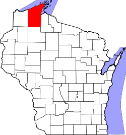
Bayfield County
![The Bayfield County Courthouse in Washburn, listed on the NRHP since 1975 [1]](https://upload.wikimedia.org/wikipedia/commons/thumb/2/26/Bayfield_County_WI_Courthouse.JPG/298px-Bayfield_County_WI_Courthouse.JPG) The Bayfield County Courthouse in Washburn, listed on the NRHP since 1975 |
|
| administration | |
|---|---|
| US state : | Wisconsin |
| Administrative headquarters : | Washburn |
| Address of the administrative headquarters: |
Bayfield County Courthouse 117 E 5Th Street Washburn, WI 54891-4522 |
| Foundation : | 1835 |
| Area code : | 715 |
| Demographics | |
| Residents : | 15,014 (2010) |
| Population density : | 3.9 inhabitants / km 2 |
| geography | |
| Total area : | 5288 km² |
| Water surface : | 1464 km² |
| map | |
| Website : www.barroncountywi.gov | |
The Bayfield County is a county in the US -amerikanischen State Wisconsin . In 2010 , the county had 15,014 residents and a population density of 3.9 people per square kilometer. The county seat is Washburn .
geography
The county is located in northern Wisconsin on the south shore of Lake Superior , the largest of the five Great Lakes . It has a total area of 5288 square kilometers, which are divided into 3823 square kilometers of land and 1464 square kilometers (27.69 percent) of water. Bayfield County borders on the following neighboring counties:
|
Lake County, Minnesota 1 |
||
| Douglas County |

|
Ashland County |
| Sawyer County | Washburn County |
1 - Maritime limit in the Upper Lake
population
| Population development | |||
|---|---|---|---|
| Census | Residents | ± in% | |
| 1900 | 14,392 | - | |
| 1910 | 15,987 | 11.1% | |
| 1920 | 17,201 | 7.6% | |
| 1930 | 15.006 | -12.8% | |
| 1940 | 15,827 | 5.5% | |
| 1950 | 13,760 | -13.1% | |
| 1960 | 11,910 | -13.4% | |
| 1970 | 11,683 | -1.9% | |
| 1980 | 13,822 | 18.3% | |
| 1990 | 14.008 | 1.3% | |
| 2000 | 15,013 | 7.2% | |
| 2010 | 15,014 | 0% | |
| 2012 estimate | 45,733 | 204.6% | |
| 1900–1990 2000 2010–2012 | |||
As of the 2010 census , Bayfield County had 15,014 people in 6,852 households. The population density was 3.9 inhabitants per square kilometer. Statistically, 2.18 people lived in each of the 6852 households.
The racial the population was composed of 86.4 percent white, 0.5 percent African American, 10.2 percent Native American, 0.3 percent Asian and other ethnic groups; 2.7 percent were descended from two or more races. Hispanic or Latino of any race was 1.3 percent of the population, regardless of ethnicity.
18.5 percent of the population were under 18 years old, 59.2 percent were between 18 and 64 and 22.3 percent were 65 years or older. 48.9 percent of the population was female.
The median income for a household was 44,190 USD . The per capita income was $ 24,502. 13.3 percent of the population lived below the poverty line.
Bayfield County localities
Census-designated places (CDP)
Other Unincorporated Communities
1 - predominantly in Ashland County
structure
Bayfield County is divided into 25 towns along with the four incorporated municipalities :
|
|
|
See also
Individual evidence
- ↑ Extract from the National Register of Historic Places - No. 75000060.Retrieved August 11, 2013
- ↑ Bayfield County in the United States Geological Survey's Geographic Names Information System.Retrieved February 22, 2011
- ↑ a b c U.S. Census Bureau, State & County QuickFacts - Bayfield County, WI. Retrieved August 11, 2013
- ^ A b National Association of Counties. Retrieved August 11, 2013
- ^ Extract from Census.gov.Retrieved February 28, 2011
- ↑ Missouri Census Data Center - Wisconsin ( page no longer available , search in web archives ) Info: The link was automatically marked as defective. Please check the link according to the instructions and then remove this notice. Retrieved August 11, 2013
Web links
Coordinates: 46 ° 38 ′ N , 91 ° 11 ′ W
