Itasca County
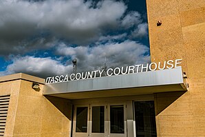
 The Itasca County Courthouse in Grand Rapids |
|
| administration | |
|---|---|
| US state : | Minnesota |
| Administrative headquarters : | Grand Rapids |
| Address of the administrative headquarters: |
County Courthouse 123 Northeast 4th Street Grand Rapids, MN 55744-2659 |
| Foundation : | October 27, 1849 |
| Made up from: | "free" territory |
| Area code : | 001 218 |
| Demographics | |
| Residents : | 45,058 (2010) |
| Population density : | 6.5 inhabitants / km 2 |
| geography | |
| Total area : | 7583 km² |
| Water surface : | 680 km² |
| map | |
| Website : www.co.itasca.mn.us | |
The Itasca County is a county in the US -amerikanischen State Minnesota . In 2010 the county had 45,058 residents and a population density of 6.5 people per square kilometer. The county seat is Grand Rapids .
Portions of the Leech Lake Reservation and the Bois Forte Reservation are in Itasca County.
geography
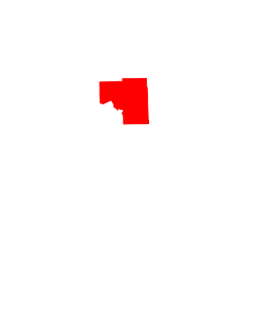
The county is located in northern Minnesota and is about 100 km from Canada and is traversed by the upper Mississippi . It has an area of 7583 square kilometers, of which 680 square kilometers are water surface. The following neighboring counties border Itasca County:
| Koochiching County | ||
| Beltrami County |

|
St. Louis County |
| Cass County | Aitkin County |
history
Itasca County was formed on October 27, 1849 from territory that was designated as free - but actually inhabited by Indians . It was named after Lake Itasca , whose name is derived from the Latin expression "ver itas ca put". The lake is not in Itasca County, but around 150 km west in Clearwater County .
21 buildings and sites in the county are listed on the National Register of Historic Places (as of January 29, 2018).
Demographic data
| Population development | |||
|---|---|---|---|
| Census | Residents | ± in% | |
| 1850 | 97 | - | |
| 1860 | 51 | -47.4% | |
| 1870 | 96 | 88.2% | |
| 1880 | 124 | 29.2% | |
| 1890 | 743 | 499.2% | |
| 1900 | 4573 | 515.5% | |
| 1910 | 17.208 | 276.3% | |
| 1920 | 23,876 | 38.7% | |
| 1930 | 27,224 | 14% | |
| 1940 | 32,996 | 21.2% | |
| 1950 | 33,321 | 1 % | |
| 1960 | 38.006 | 14.1% | |
| 1970 | 35,530 | -6.5% | |
| 1980 | 43,069 | 21.2% | |
| 1990 | 40,863 | -5.1% | |
| 2000 | 43.992 | 7.7% | |
| 2010 | 45,058 | 2.4% | |
| Before 1900 1900–1990 2000 2010 | |||
According to the 2010 census , Itasca County had 45,058 people in 18,761 households. The population density was 6.5 people per square kilometer. Statistically, 2.35 people lived in the 18,761 households.
The racial the population was composed of 93.7 percent white, 0.4 percent African American, 3.6 percent Native American, 0.4 percent Asian and other ethnic groups; 2.0 percent were descended from two or more races. Hispanic or Latino of any race was 1.1 percent of the population.
21.6 percent of the population were under 18 years old, 59.2 percent were between 18 and 64 and 19.2 percent were 65 years or older. 49.5 percent of the population was female.
The median income for a household was 47,106 USD . The per capita income was $ 24,067. 11.4 percent of the population lived below the poverty line.
Localities in Itasca County
Census-designated places (CDP)
Other Unincorporated Communities
1 - partly in St. Louis County
structure
Itasca County is divided into twelve cities 1 in 41 townships (TS) and four unorganized territories (UT):
|
1 The cities of Calumet, Marble, Nashwauk and Taconite each belong to a township.
See also
Individual evidence
- ↑ GNIS-ID: 659476. Retrieved on February 22, 2011 (English).
- ↑ a b c U.S. Census Bureau, State & County QuickFacts - Itasca County, MN ( July 12, 2011 memento on WebCite ) Retrieved April 28, 2013
- ^ A b National Association of Counties , Retrieved April 28, 2013.
- ↑ Search mask database in the National Register Information System. National Park Service , accessed January 29, 2018.
- ^ US Census Bureau _ Census of Population and Housing , Retrieved February 17, 2011.
- ↑ Extract from Census.gov . Retrieved February 17, 2011
- ^ Census 2010 - Minnesota , Retrieved May 5, 2020
Web links
Coordinates: 47 ° 31 ' N , 93 ° 38' W


