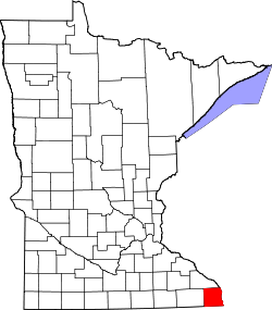
Houston County, Minnesota
![The Houston County Courthouse in Caledonia, listed on NRHP No. 83000905 [1]](https://upload.wikimedia.org/wikipedia/commons/thumb/7/7f/HoustonCountyMinnesota2006.JPG/298px-HoustonCountyMinnesota2006.JPG) The Houston County Courthouse in Caledonia, listed on NRHP No. 83000905 |
|
| administration | |
|---|---|
| US state : | Minnesota |
| Administrative headquarters : | Caledonia |
| Address of the administrative headquarters: |
County Courthouse 304 South Marshall Street Caledonia, MN 55921-1389 |
| Foundation : | April 4, 1854 |
| Made up from: | Fillmore County |
| Area code : | 001 507 |
| Demographics | |
| Residents : | 19,027 (2010) |
| Population density : | 13.2 inhabitants / km 2 |
| geography | |
| Total area : | 1473 km² |
| Water surface : | 27 km² |
| map | |
| Website : www.co.houston.mn.us | |
The Houston County is a county in the US -amerikanischen State Minnesota . In 2010 , the county had 19,027 residents and a population density of 13.2 people per square kilometer. The county seat is Caledonia .
geography
The county is located in the extreme southeast of Minnesota. It is bordered by Iowa to the south and Wisconsin to the east , with the Mississippi as the natural boundary. The county has an area of 1,473 square kilometers, of which 27 square kilometers are water. The Root River , coming from the west, flows into the Mississippi in the east of the county. The following neighboring counties border Houston County:
| Winona County |
La Crosse County, Wisconsin |
|
| Fillmore County |

|
Vernon County, Wisconsin |
|
Winneshiek County, Iowa |
Allamakee County, Iowa |
history
Houston County was formed on April 4, 1854 from parts of Fillmore County. It was named after Sam Houston (1793–1863), an American politician and general who is considered a key figure in the history of the state of Texas . After him was Houston , the fourth largest city in the United States named.
15 buildings and sites in the county are listed on the National Register of Historic Places (as of January 29, 2018).
Demographic data
| Population development | |||
|---|---|---|---|
| Census | Residents | ± in% | |
| 1860 | 6645 | - | |
| 1870 | 14,936 | 124.8% | |
| 1880 | 16,332 | 9.3% | |
| 1890 | 14,653 | -10.3% | |
| 1900 | 15,400 | 5.1% | |
| 1910 | 14,297 | -7.2% | |
| 1920 | 14,013 | -2% | |
| 1930 | 13,845 | -1.2% | |
| 1940 | 14,735 | 6.4% | |
| 1950 | 14,435 | -2% | |
| 1960 | 16,588 | 14.9% | |
| 1970 | 17,556 | 5.8% | |
| 1980 | 18,382 | 4.7% | |
| 1990 | 18,497 | 0.6% | |
| 2000 | 19,718 | 6.6% | |
| 2010 | 19,027 | -3.5% | |
| Before 1900 1900–1990 2000 2010 | |||

As of the 2010 census , Houston County had 19,027 people in 7,810 households. The population density was 13.2 inhabitants per square kilometer. Statistically, 2.4 people lived in each of the 7810 households.
The racial the population was composed of 97.5 percent white, 0.6 percent African American, 0.2 percent Native American, 0.5 percent Asian and other ethnic groups; 1.2 percent were descended from two or more races. Hispanic or Latino of any race was 0.8 percent of the population.
22.4 percent of the population were under 18 years old, 60.2 percent were between 18 and 64 and 17.4 percent were 65 years or older. 50.2 percent of the population was female.
The median income for a household was 53,017 USD . The per capita income was $ 25,791. 9.0 percent of the population lived below the poverty line.
Houston County localities
1 - partially in Winona County
structure
Houston County is divided into 17 townships in addition to the seven cities :
|
|
See also
Individual evidence
- ^ Extract from the National Register of Historic Places . Retrieved March 13, 2011
- ↑ GNIS-ID: 659473. Retrieved on February 22, 2011 (English).
- ↑ a b c U.S. Census Bureau, State & County QuickFacts - Houston County, MN ( July 11, 2011 memento on WebCite ) Retrieved January 23, 2013
- ^ A b National Association of Counties.Retrieved January 23, 2013
- ↑ Search mask database in the National Register Information System. National Park Service , accessed January 29, 2018.
- ^ US Census Bureau - Census of Population and Housing.Retrieved March 15, 2011
- ^ Extract from Census.gov.Retrieved February 18, 2011
- ^ Census 2010 - Minnesota , Retrieved May 5, 2020
Web links
Coordinates: 43 ° 40 ′ N , 91 ° 29 ′ W

