Minnetonka
| Minnetonka | ||
|---|---|---|
 Minnetonka Community Center |
||
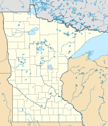
| Location in Minnesota | ||
|
|
||
| Basic data | ||
| Foundation : | 1850 | |
| State : | United States | |
| State : | Minnesota | |
| County : | Hennepin County | |
| Coordinates : | 44 ° 55 ′ N , 93 ° 30 ′ W | |
| Time zone : | Central ( UTC − 6 / −5 ) | |
|
Inhabitants : - Metropolitan Area : |
49,734 (as of 2010) 2,968,805 |
|
| Population density : | 707.5 inhabitants per km 2 | |
| Area : | 73.1 km 2 (approx. 28 mi 2 ) of which 70.3 km 2 (approx. 27 mi 2 ) is land |
|
| Height : | 271 m | |
| Postcodes : | 55305, 55343, 55345 | |
| Area code : | +1 952 | |
| FIPS : | 27-43252 | |
| GNIS ID : | 0647949 | |
| Website : | www.eminnetonka.com | |
| Mayor : | Jan Callison | |
Minnetonka is a city in Hennepin County in the US state of Minnesota . It is located about 13 kilometers west of Minneapolis and St. Paul in the metropolitan area of the Twin Cities and has 49,734 inhabitants ( 2010 census ).
geography
Minnetonka is a suburb of the major cities of Minneapolis and St. Paul in the American Midwest . The metropolitan area includes a small portion of eastern Lake Minnetonka , one of the largest lakes in Minnesota. It flows over the Minnehaha Creek through Minnetonka and flows into the Mississippi River at the Minnehaha Falls in Minneapolis . According to the United States Census Bureau , the area of the city is 73.1 square kilometers, of which 2.9 square kilometers are water.
history
The Ojibwa and Dakota Indians were among the first to settle in what is now Minnetonka . The first records of explorers of European descent date back to 1822 when Fort Snelling was built and explorations were made from Minnehaha Creek to Lake Minnetonka. With the Treaty of Traverse des Sioux , the territories passed into the possession of the United States. The first census from 1857 describes 41 households in Minnetonka Township. The timber industry with the sawmills on Minnehaha Creek was important for further development .
In 1956 Minnetonka was given city rights.
Population development
| 1970 | 1980 | 1990 | 2000 | 2010 |
|---|---|---|---|---|
| 35,776 | 38,683 | 48,370 | 51,301 | 49,734 |
Demographic data
According to the 2000 census, Minnetonka has 51,301 people in 21,393 households and 14,097 families. The racial the population is made up of 94.4 percent white population, 2.3 percent Asian-American, 1.5 percent African American and smaller minorities.
Children under the age of 18 live in 29.1% of the 21,393 households, married couples in 56.6%, female singles in 6.8% and 34.1% are not family households. 27.3% of all households consist exclusively of a single person and 9.3% are single people over 65 years of age. The average household size is 2.37 people, that of families 2.92.
In relation to the entire city, the population is composed of 23.1% residents under 18 years of age, 6.0% between 18 and 24 years of age, 28.5% between 25 and 44 years of age, 28.4% between 45 and 64 years of age 14.0% over 65 years. The median is 41 years. About 52.1% of the population is female.
The median income of a household is USD 69,979 and that of a family is USD 85,437. The per capita income is $ 40,410. About 2.6% of the population and 1.5% of families live below the poverty line.
Economy and Transport
With the feed and food company Cargill (142,000 employees worldwide) and the insurance company UnitedHealth (around 55,000 employees) as well as Polaroid , 3 major companies have their headquarters in Minnetonka.
Interstate 494 runs through Minnetonka in a north-south direction , which is a feeder to Interstate 94 and connects Minnetonka south with Interstate 35-W and passes Minneapolis-Saint Paul Airport . The Interstate 394 leads east out of the city to Minneapolis and ends at Interstate 94th
sons and daughters of the town
- Dave Snuggerud (born 1966), professional ice hockey player
- Becky Lavelle (* 1974), triathlete
- Andrew Erickson (born 1976), biathlete
- Jack Hillen (* 1986), ice hockey player
- Jimmy Schuldt (* 1995), ice hockey player
Web links
- Minnetonka Historical Society (English)
