Rousínov (Svor)
| Rousínov | ||||
|---|---|---|---|---|
|
||||
| Basic data | ||||
| State : |
|
|||
| Region : | Liberecký kraj | |||
| District : | Česká Lípa | |||
| Municipality : | Svor | |||
| Geographic location : | 50 ° 48 ' N , 14 ° 36' E | |||
| Height: | 440 m nm | |||
| Residents : | 39 (March 1, 2001) | |||
| Postal code : | 471 57 | |||
| License plate : | L. | |||
| traffic | ||||
| Street: | Svor - Rousínov | |||

Rousínov (German Morgenthau ) is a district of the municipality of Svor in the Czech Republic . It is located three and a half kilometers northwest of Cvikov and belongs to the Okres Česká Lípa .
geography
Rousínov extends in the Lusatian Mountains in the valley of the Rousínovský potok ( Friedrichsbach ), which is now considered as the upper reaches of the Boberský potok ( Boberbach ). At the lower end of the village, the Kohoutí potok ( Hahnenbach ) flows into the Rousínovský potok. The Pařez ( Klötzerberg , 536 m), the Bouřný ( Friedrichsberg , 703 m) and the Kobyla ( Hengstberg , 627 m) rise to the north, the Suchý vrch ( Dürrberg , 638 m) to the northeast and the Trávnický vrch ( Glasertberg , 571 m) m), in the southeast of the Kamenitý (442 m), to the south of the Hrouda ( Balleberg , 452 m), in the southwest of the Klíč ( Kleis , 760 m), to the west of the Rousínovský vrch ( Hamrich , 660 m) and in the northwest of the Velký Buk ( Großer Buchberg , 736 m). To the west and north, the E 10 / state road I / 9 between Rumburk and Prague and the Bakov nad Jizerou – Ebersbach railway pass Rousínov. The Staré Mlýny desert to the north is one of the oldest glassworks in Bohemia.
Neighboring towns are Nová Huť in the north, Horní Světlá , Dolní Světlá and Hamr in the northeast, Naděje and Trávník in the east, Cvikov and Martinovo Údolí in the southeast, Svor in the south and southwest, Jedličná, Falknov and Řachvaj in the west and Kytlice and Dolník in the north-west .
history
The Friedrichsbach valley is one of the oldest known forest glassworks in Bohemia . During excavations in the Staré Mlýny desert in the 1990s, the remains of a 13th century glassworks and a mill were found. According to ancient traditions, the extinct village of Friedrichsdorf is said to have been at the southern foot of the Friedrichsberg, but its existence cannot be proven. Presumably there was only a forest glassworks at the place. The Alte Prager Straße , coming from Görlitz via Rumburg , Jiřetín pod Jedlovou and Neuhütte , ran through the valley of the Friedrichsbach, the course of which then led to Zwickau and Böhmisch Leipa .
A permanent settlement of the lower Friedrichsbach valley probably did not begin until the end of the 14th century. On a knoll above the bottom of the Hahnenbach ( Kohoutí potok ) there was a castle , the remains of which are now called Rousínovský hrádek . The function and the original name of this simple fortification are unknown. It was certainly created in connection with that of Mühlstein Castle ; possibly it was a control room to protect Alte Prager Strasse or a refuge in the event of a siege. It was abandoned at the end of the 15th century. In 1532, the Berka von Dubá rulers united the Mühlstein rule with the Reichstadt rule .
In 1612 Johann von Kolowrat -Nowohradsky acquired the rule of Reichstadt; the first written mention of the Morgenthau settlement was made. His widow Anna Magdalena married Julius Heinrich von Sachsen-Lauenburg in 1632 . With the death of Duke Julius Franz von Sachsen-Lauenburg , the male line of the Dukes of Sachsen-Lauenburg died out in 1689. Through marriage and inheritance, the Reichstadt rule came to various owners; among them to the Count of Pfalz-Neuburg from the House of Wittelsbach , Ferdinand Maria of Bavaria , to the family of Archduke Ferdinand of Tuscany from the House of Habsburg-Lothringen and finally to Napoleon Franz Bonaparte .
In 1754 the place consisted of 31 houses. Between 1794 and 1797, the Alte Prager Strasse was expanded to become the Kaiserstrasse, with a new route east of the Schöber over the Schöbersattel and Neuhütte and west of the Bouřný to Röhrsdorf .
In 1832 Morgenthau , also known as Morgenthal , consisted of 43 houses with 319 German-speaking residents. In the village, which is surrounded by forests, there was a grinding mill and six glass grinding shops, in which mostly glass beads were produced. The parish was in Zwickau . Morgenthau remained subject to the allodial rule of Reichstadt until the middle of the 19th century .
After the abolition of patrimonial Morgenthau formed from 1850 a district of the municipality Röhrsdorf in the Bunzlauer Kreis and judicial district Zwickau. From 1868 Morgenthau belonged to the Gabel district . The construction of a rail link between Rumburg and Böhmisch Leipa, begun in 1867 by the kk priv. Böhmische Nordbahn-Gesellschaft , was completed after a year and a half. Its course south of the Schöberkamm followed the Rumburger Kaiserstraße. In 1869 the village had 520 inhabitants. In 1876 a school opened in Morgenthau. In the course of the tourist development of the Lusatian Mountains, which began at the end of the 19th century, the remote place developed into a summer resort, which was visited by day trippers from Bohemia and Saxony. In 1899 399 people lived in Morgenthau. In 1910 the village had grown to 69 houses with 445 inhabitants. The Czech name Rousínov was introduced in 1924. In 1930, 448 people lived in the 77 houses in the village. After the Munich Agreement , it was incorporated into the German Empire in 1938 and Morgenthau belonged to the Deutsch Gabel district . In 1939 Morgenthau had 375 inhabitants. After the end of the Second World War, Morgenthau came back to Czechoslovakia. Since 1946 the place has been officially called Rousínov . In 1946 and 1947, most of the German-Bohemian residents were expelled. The repopulation was only weak. In 1948 Rousínov was assigned to the Okres Nový Bor together with Svor in the course of the abolition of the Okres Německé Jablonné. Since the beginning of the 1950s, many of the uninhabited houses have been bought up by those looking for relaxation, mainly from Prague , and then repaired as weekend houses. In 1960 Svor and Rousínov came to Okres Česká Lípa .
In 1991 Rousínov had 38 residents. In 2001 the village consisted of 38 houses in which 39 people lived. In total, the place consists of 75 houses, most of which are not permanently inhabited.
Local division
The district of Rousínov is part of the cadastral district of Svor.
Attractions
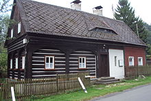
- Half-timbered houses
- Chapel of St. Lawrence
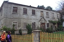
- Ruin of the mill, architectural monument
- desert castles Rousínovský hrádek and Milštejn
- Cave Vinný sklep at Kobyla
- Mill ditch of the former Rotmühle glass mill on Pařez
Web links
- The story of Svor and Rousínov on the Svor Municipality website
- Description of Rousínov on luzicke-hory.cz
- Description of the Rousínovský hrádek castle stables on luzicke-hory.cz
Individual evidence
- ↑ http://www.luzicke-hory.cz/mista/index.php?pg=zmbourd
- ^ Johann Gottfried Sommer , Franz Xaver Maximilian Zippe The Kingdom of Böhmen, Vol. 2 Bunzlauer Kreis, 1834, p. 264
- ↑ http://www.czso.cz/csu/2009edicniplan.nsf/t/010028D080/$File/13810901.pdf


