Ruta 22 (Bolivia)
| Ruta 22 in Bolivia | |||||||||||||||||||||||||

|
|||||||||||||||||||||||||
| map | |||||||||||||||||||||||||
| Basic data | |||||||||||||||||||||||||
| Operator: | Administradora Boliviana de Carreteras |
||||||||||||||||||||||||
| Overall length: | 249 km | ||||||||||||||||||||||||
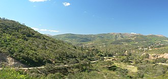
| Ruta 22 between Mataral and Trigal | |||||||||||||||||||||||||
|
Course of the road
|
|||||||||||||||||||||||||
The Ruta 22 is a national road in the South American Andean state of Bolivia .
Routing
The road has a length of 249 kilometers.
The Ruta 22 runs from north to south in the southwest part of the Santa Cruz Department and connects the Ruta 7 at Mataral with the Ruta 9 at Ipitá . The road connects the fertile plains of Vallegrande with the metropolis of Cochabamba in the north and the foothills of the Chaco in the south, with Ruta 22 running through the southeastern foothills of the Cordillera Oriental on its entire route .
The northern part of the route from Mataral to Vallegrande is paved, the remaining 198 kilometers south of Vallegrande are still unpaved.
history
The road has been declared part of the Bolivian national road network " Red Vial Fundamental " by decree 25.134 of August 31, 1998 .
Route sections
Santa Cruz Department
- km 000: Mataral - 1387 m - 939 inhabitants ( update 2010 )
- km 028: Trigal - 1,623 m - 725 inhabitants
- km 053: Vallegrande - 2,041 m - 9,304 inhabitants
- km 061: Guadalupe - 2,057 m - 711 inhabitants
- km 136: Masicurí - 715 m - 257 inhabitants
- km 249: Ipitá - 923 m - 374 inhabitants

