
Saalhausen (Freital)
|
Saalhausen
Large district town of Freital
Coordinates: 51 ° 0 ′ 42 ″ N , 13 ° 37 ′ 0 ″ E
|
|
|---|---|
| Height : | 260 m above sea level NHN |
| Area : | 1.01 km² |
| Residents : | 128 (December 31, 2017) |
| Population density : | 127 inhabitants / km² |
| Incorporation : | 1st January 1973 |
| Postal code : | 01705 |
| Area code : | 0351 |
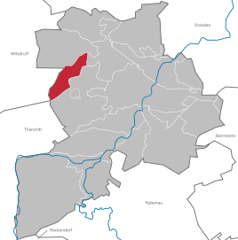  Location of Saalhausen in Freital
|
|
Saalhausen is a district of the Saxon large district town of Freital in the district of Saxon Switzerland-Eastern Ore Mountains .
geography
Saalhausen is located in the west of the Freital city area, directly on the Weißiger Forest. The place borders in the northwest of the Wilsdruffer district Oberhermsdorf and in the southwest Kleinopitz . Furthermore, the Freitaler districts Wurgwitz in the north, Zauckerode in the northeast, Döhlen in the east and southeast and Weißig in the south join.
The only road to Saalhausen leads from State Road 36 in Zauckerode into the town center. A forest path connects the place with Weißig and with Oberhermsdorf . The connection of Saalhausen to the local public transport is guaranteed by the Freital city bus line C of the regional traffic Saxon Switzerland-Eastern Ore Mountains. The next train station is in Potschappel.
history
The first written mention comes from the year 1350 with the name Salesen . The population did not exceed the limit of 600, in 1849 about 205 citizens lived in the community, 50 years later there were already 450 citizens.
Saalhausen was parish in Pesterwitz , and the children attended the school there. The school was later moved to the Zauckeroder school, and in 1859 the community built its own school building. The place still belongs to the parish of Pesterwitz today.
In 1882 the Royal Saxon Ministry established a " correctional institution for work-shy" in the community. In the course of time, the character of the district institution changed into a nursing home for the sick, sick and disabled. During the First World War soldiers were cared for. During the GDR era, the complex was converted into the Freital-Saalhausen district nursing home. The nursing home was dissolved between 1988 and 1992. A new home was built in Freital on Leßkestrasse. The old district nursing home has been deteriorating more and more in recent years.
On January 1, 1973, the place was incorporated into Freital and has been a district of the city ever since.
Development of the population
|
|
Web links
- District Saalhausen on freital.de
- Saalhausen in the Digital Historical Directory of Saxony
Individual evidence
- ↑ Update of the Integrated Urban Development Concept (INSEK). (PDF; 120 MB) Urban development Freital 2030plus. Stadtverwaltung Freital, STEG Stadtentwicklung GmbH, January 2020, p. 92 , accessed on July 13, 2020 .
- ↑ Federal Statistical Office (Ed.): Municipalities 1994 and their changes since 01.01.1948 in the new federal states . Metzler-Poeschel, Stuttgart 1995, ISBN 3-8246-0321-7 .
- ↑ Saalhausen in the Digital Historical Directory of Saxony
Birkigt | Burgk | Deuben | Döhlen | Hainsberg | Kleinnaundorf | Ugly | Pesterwitz | Potschappel | Saalhausen | Schweinsdorf | Somsdorf | Whitish | Wurgwitz | Zauckerode
Birkigt | Coßmannsdorf | Deuben | Döhlen | Großburgk | Hainsberg | Kleinburgk | Kleinnaundorf | Kohlsdorf | Ugly | Niederhermsdorf | Niederpesterwitz | Oberpesterwitz | Potschappel | Saalhausen | Schweinsdorf | Somsdorf | Under white | Whitish | Wurgwitz | Zauckerode | Zschiedge