Spur mill
| Spormühle, formerly "Obermühle"
|
||
|---|---|---|
|
Spormühle from the gatehouse |
||
| Location and history | ||
|
|
||
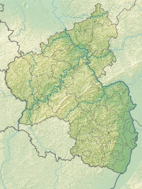
| Coordinates | 49 ° 33 '35 " N , 8 ° 14' 41" E | |
| Location | Dirmstein | |
| Waters | Eckbach | |
| Built | before the 15th century | |
| Shut down | 1955 | |
| Status | Use as a sponsoring and event agency | |
| technology | ||
| use | Watermill | |
| Grinder | two grinds | |
| water wheel | undershot | |
The Spormühle in the Rhineland-Palatinate municipality of Dirmstein was a water-powered mill on the Eckbach . It is a listed building and is used today as a sponsoring and event agency.
Geographical location
The Spormühle is located in the southwest of the village, where the Eckbach from Laumersheim reaches the Dirmstein district. To distinguish it from the Niedermühle at the eastern exit of the village, it was once called Obermühle . The lower end of the 23 km long Eckbach-Mühlenwanderweg is at the mill .
investment
Residential and functional buildings enclose at right angles to the west, south (where the Eckbach flows past) and east a large paved inner courtyard, which is bordered to the north by a man-high wall. In the west is the one-and-a-half-story house with a gable roof and dormers , the southwest corner is taken up by the four- story , two-part mill building, in the south there is a flat warehouse and in the east the gatehouse .
Technically, it was a grinder with two grinders and undershot water wheels . In view of the flat terrain, these reached down into the current and were not supplied with water from above via reservoirs and canals - overshot . The undershot technology is simpler, but less effective and also prone to flooding because the mill wheel can no longer rotate when its axis of rotation is flooded. The fact that this type of operation was nevertheless chosen is proof that in the past the water flow of the Eckbach was always sufficient at the site of the mill, while the risk of flooding was negligible.
Building history
The Spormühle was first mentioned in the 15th century, but the parts of its structure that have been preserved are certainly considerably older. In the Middle Ages it was located southwest of Dirmstein, about 250 meters up the Eckbach outside the village.
At the time it was first mentioned, it belonged to the Martinsstift in Worms . A long series of preserved documents begins in 1447 with an inheritance , a kind of long-term lease , to Henner Kubel and his wife Catharin . A stocker was obliged to keep the banks of the stream clean and the flow of water continuous at his own expense. Later the aristocratic family Sturmfeder also belonged to the inheritance .
In the course of its history the mill burned down several times and was even completely destroyed in the Thirty Years War . However, it was built up again and again. The keystone of the archway at the gatehouse from the Rococo period bears the carved date 1757.
When the French Revolution attacked the Palatinate towards the end of the 18th century , the entire church property was auctioned, including the Spormühle, which was last in the possession of the Bishop of Worms . At that time, Joseph von Camuzi (1767–1828), who was Dirmstein's mayor from 1801 to 1815, acquired the property. The mill has been privately owned since then.
In the 20th century, Dirmstein also expanded to the southwest, so that the Spormühle is now within the village. In 1937 the mill was converted for the purpose of generating electricity from hydropower, and in 1955 it was finally shut down.
Todays use
In September 2015 the Spormühle changed hands. Torhaus, Remise, Hochkeller and Turmhaus have been used as a sponsoring and event agency since 2018/19 after renovation.
literature
- Georg Peter Karn, Ulrike Weber (arrangement): Bad Dürkheim district. City of Grünstadt, Union communities Freinsheim, Grünstadt-Land and Hettenleidelheim (= cultural monuments in Rhineland-Palatinate. Monument topography Federal Republic of Germany . Volume 13.2 ). Wernersche Verlagsgesellschaft, Worms 2006, ISBN 3-88462-215-3 .
Web links
- Spormühle Dirmstein , entry on Facebook
Individual evidence
- ^ Georg Peter Karn, Ulrike Weber: Monument topography Federal Republic of Germany . tape 13 : Bad Dürkheim district . Part 2: City of Grünstadt, Union communities Freinsheim, Grünstadt-Land and Hettenleidelheim , 2006.
- ↑ a b Eva Briechle: A dream come true in the old walls. In: The Rhine Palatinate . April 9, 2019, accessed November 29, 2019 .


