Niedermühle (Dirmstein)
| Niedermühle
|
||
|---|---|---|
|
Main building of the Niedermühle |
||
| Location and history | ||
|
|
||
| Coordinates | 49 ° 33 '46 " N , 8 ° 15' 40" E | |
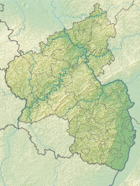
| Location | Dirmstein , Niederdorf | |
| Waters | Eckbach | |
| Built | Middle Ages , new building 1857 | |
| Shut down | 19th century | |
| Status | Use as an estate | |
| technology | ||
| use | Watermill | |
| Grinder | three grinds , one shot | |
| water wheel | undershot | |
The Niedermühle in the Rhineland-Palatinate municipality of Dirmstein was a water-powered mill on the Eckbach . Today it is used as an estate and is a listed building .
Geographical location
The Niedermühle is located at Gerolsheimer Str. 13 in the east of the village on the edge of the Niederdorf and to the left of the Eckbach, which leaves the Dirmsteiner residential development there. The Floßbach flows to the east from the left . To the west, the cemetery with the first parish church of the place, which was consecrated to St. Peter , used to extend .
investment
The spacious 19th century property is grouped around a rectangular courtyard. Today's hipped roof house stands on the site of the first mill building; it is set back from the street and separated from it by a half-height wall. The late Classicist plastered facade with stone- framed arched windows is divided into three sections by pilaster strips . The knee stick shows a rectangular opening above each window. The window division was subsequently renewed, the wooden shutters are partially preserved. The ground floor is divided by a central corridor, and a wooden staircase with a cast iron railing leads upstairs. A vaulted cellar , which consists of two parallel barrels , extends under the building . A highlight among the farm buildings is the large barn to the right of the courtyard, which has three arched gates framed by brickwork.
Building history
Originally with three grinding passes and a shot-transition -equipped mill has existed since the Middle Ages . She worked with undershot water wheels . In view of the flat terrain, these reached down into the current and were not supplied with water from above via reservoirs and canals - overshot .
After the main building became dilapidated, it was demolished in the middle of the 19th century and rebuilt in 1857 by Christian Janson and his son Jakob . The farm buildings were renewed in 1882/83 by the grandson Jakob II. Janson .
The largest barn burned down on the night of May 25th to 26th, 2009 after a lightning strike that occurred around 4:00 am; the roof of the main house was also affected. The fire brigade, which was deployed with 60 people, estimated the total damage at € 400,000.
literature
- Georg Peter Karn, Ulrike Weber (arrangement): Bad Dürkheim district. City of Grünstadt, Union communities Freinsheim, Grünstadt-Land and Hettenleidelheim (= cultural monuments in Rhineland-Palatinate. Monument topography Federal Republic of Germany . Volume 13.2 ). Wernersche Verlagsgesellschaft, Worms 2006, ISBN 3-88462-215-3 .
Individual evidence
- ↑ a b The names Oberdorf and Niederdorf for the two settlement centers of the municipality are derived from the location above and below at the Eckbach , which flows through Dirmstein from west to east.
- ^ General Directorate for Cultural Heritage Rhineland-Palatinate (ed.): Informational directory of cultural monuments - Bad Dürkheim district. Mainz 2020, p. 27 (PDF; 5.1 MB).
- ↑ Dirmstein: Barn fire after lightning strike. (PDF; 17.86 kB) Fire Brigade Operations Center Grünstadt-Land, May 26, 2009, accessed on February 17, 2016 .


