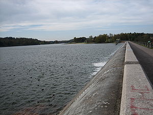
Bouzey reservoir
| Reservoir de Bouzey | |||||||||
|---|---|---|---|---|---|---|---|---|---|
|
|||||||||
|
|
|||||||||
| Coordinates | 48 ° 10 '2 " N , 6 ° 21' 23" E | ||||||||
| Data on the structure | |||||||||
| Construction time: | 1879-1882 | ||||||||
| Height above foundation level : | 22 m | ||||||||
| Height of the structure crown: | 371.95 m | ||||||||
| Crown length: | 520 m | ||||||||
| Crown width: | 4 m | ||||||||
| Base width: | 11.35 m | ||||||||
| Data on the reservoir | |||||||||
| Water surface | 1.4 km² | ||||||||
| Storage space | 7 million m³ | ||||||||
| Particularities: |
Water depth: 20 m |
||||||||
| The Bouzey dam in 2005 | |||||||||
| After the disaster of 1895 | |||||||||
The Bouzey reservoir (Réservoir de Bouzey) is located about ten kilometers west of Épinal , on the western edge of the Vosges Mountains in the French department of Vosges . The reservoir, with an area of around 140 hectares , provides a constant water supply to the Canal des Vosges (until 2003: Canal de L'Est ) and is located in the area of the municipalities of Sanchey , Chaumousey , Girancourt and Renauvoid . Even before Lac de Gérardmer, it forms the largest body of water in the Vosges department.
The water is supplied to the reservoir by the natural tributaries coming from the south and southwest (including the Avière with a length of 2.5 km) and by the 42-kilometer Canal d'Alimentation du Reservoir de Bouzey . It branches off from the upper Moselle in the municipality of Saint-Étienne-lès-Remiremont near Remiremont and crosses or undercrosses 114 tunnels or bridges on its course on the left bank of the Moselle. Excess water that is not required for keeping the apex is drained via the Avière River, which flows into the Moselle after 28 kilometers near Nomexy .
The dam
The dam was built from 1879 to 1882 near Épinal and Belfort in the Vosges to supply the Canal de L'Est and was commissioned in 1880. It was founded on sandstone , but not deep enough to a stable rock. She was a gravity dam made of masonry . Back then, people did not have the necessary knowledge about the statics of dams. The wall was miscalculated by today's standards and was therefore much too slim. A 2 m thick layer was laid on the water side to seal the wall. However, this should hardly have had an effect, penetrating water generated buoyancy forces under the wall.
Structural damage
As early as 1884 there was damage from seepage water. This probably penetrated through cracks caused by tensile stress. On March 15, 1884, the wall slipped 135 m in length on a horizontal layer of clay by up to 280 mm down into the valley. There was some property damage, but there was no death. The wall was bent afterwards and had numerous cracks. This one tried unsuccessfully to seal. In 1888 the lower part of the wall was reinforced to prevent it from sliding further. But it remained in the upper part without reinforcement and very slim. It was also strongly concave on the air side .
The catastrophe
On April 27, 1895 (April 25, 1895 is sometimes mentioned) the dam was completely dammed during a flood . Due to the load, the wall fell over in one piece over a length of 171 m and at a height of 12 m. The number of deaths from the tidal wave is given differently with 86, 87, 90, 100, 150 or even 200. The property damage was considerable, the villages of Sanchey , Uxegney and Domèvre-sur-Avière as well as parts of Chaumousey on the upper reaches of the Avière were on most heavily destroyed, also Oncourt , Frizon and finally the industrial community of Nomexy , where the tidal wave hit the Moselle valley, were affected.
In France there has only been one other case of a dam disaster to date , namely the accident of the Barrage de Malpasset (near Fréjus ) on December 2, 1959.
Current condition
The dam was rebuilt, the lake still serves to supply the Canal des Vosges. An earthquake on February 22nd, 2003 damaged the dam again, the consequences are being investigated. Today the lake has a high recreational value in addition to its practical importance. There is a restaurant and a campsite on the shore, a sailing school is available and there are swimming opportunities. A 15 km long cycle path leads to the port and the town of Épinal, for whose residents the lake is a recreational area .
literature
- R. Pohl: History of Hydraulic Engineering , Technische Universität Dresden, Institute for Hydraulic Engineering and Technical Hydromechanics, 2004
- NA Smith: Unhappy Anniversary - The Disaster at Bouzey in 1895 ; International Water Power & Dam Construction, April 1995; P. 40.
- Bruno Théveny, supplément de la Liberté de l'Est, April 27, 1995 (newspaper)
- JD van Buren: Notes on High Masonry Dams . Transactions of the American Society of Civil Engineers, Vol. XXXIV, 1895
Individual evidence
- ↑ Léon Gaire: History of the textile factories in Nomexy and Portieux ( Memento of the original from October 23, 2011 in the Internet Archive ) Info: The archive link was automatically inserted and not yet checked. Please check the original and archive link according to the instructions and then remove this notice.


