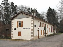
Renauvoid
| Renauvoid | ||
|---|---|---|
|
|
||
| region | Grand Est | |
| Department | Vosges | |
| Arrondissement | Epinal | |
| Canton | Epinal-1 | |
| Community association | Epinal | |
| Coordinates | 48 ° 9 ' N , 6 ° 23' E | |
| height | 369-478 m | |
| surface | 9.36 km 2 | |
| Residents | 118 (January 1, 2017) | |
| Population density | 13 inhabitants / km 2 | |
| Post Code | 88390 | |
| INSEE code | 88388 | |
 Location of the municipality of Renauvoid in the Vosges department |
||
Renauvoid is a French commune with 118 inhabitants (as of January 1, 2017) in the Vosges department in the Grand Est region ( Lorraine until 2015 ). It belongs to the Arrondissement Épinal and since 2012 the municipal association Agglomération d'Épinal .
geography
The municipality of Renauvoid is six kilometers southwest of Épinal . The municipality is located in the northeast of the Voge -Hochfläche that the catchment areas of the Rhine and Saône separates and the main European watershed forms.
The Moselle tributaries Ruisseau d'Olima, Ruisseau de Bertamenil and the 28 km long Avière as well as the Ruisseau des Colnots , which drains over the Ruisseau des Sept Pecheurs and the Côney to the Saône, arise in Renauvoid . In the northwest, Renauvoid has an approximately seven-hectare portion of the Bouzey reservoir , which was created to keep the Canal des Vosges apex and is now an important local recreation area in the nearby town of Épinal.
The abundance of forests is characteristic of Renauvoid. The forests (in the northeast of the Forêt domaniale du Ban d'Uxeguey , in the south and west of the Forêt d'Avière ) make up three quarters of the municipal area.
Renauvoid does not have a clearly defined town center, but consists of the scattered hamlets of La Basse Henry, La Verrière, Le Savernay, Les Censes des Lois, Le Treize Canton and Olima .
Neighboring municipalities of Renauvoid are Sanchey and Les Forges in the north, Chantraine in the northeast, Épinal in the east, Uriménil and Uzemain in the south, Girancourt in the west and Chaumousey in the northwest.
history
Due to the structure of the scattered farms and hamlets without a grown village center, there are hardly any historical records about Renauvoid. At the time of the founding of the Abbey of Deuilly in 1044, the area of the current municipality belonged to the ban of Girandi Curtis , who in addition to Renauvoid (formerly Renaufief ) also the places Void-de-Girancourt, Audoncourt, Barbonfaing, Dommartin-aux-Bois, Hagémont, Méloménil, Nayémont, Thiélouze and Uzemain and whose center was in what is now Girancourt .
On July 29, 1944, a Royal Air Force Lancaster bomber crashed near Renauvoid on the way to Stuttgart with seven soldiers from Great Britain, Canada and New Zealand. Six crew members are buried in the military cemetery in Chaumousey , a New Zealand soldier survived. A memorial was erected in 2002 at the crash site in Forêt d'Avière.
Population development
| year | 1962 | 1968 | 1975 | 1982 | 1990 | 1999 | 2006 | 2017 | |
| Residents | 69 | 90 | 72 | 72 | 90 | 103 | 117 | 118 | |
| Sources: Cassini and INSEE | |||||||||
The forest location on the Bouzey reservoir and the proximity to the capital of the department, Épinal , attracted more and more townspeople to Renauvoid at the end of the 20th century.

Economy and Infrastructure
In the municipality there are no employment opportunities outside of agriculture and forestry, so Renauvoid is mainly the residence of commuters to the nearby town of Épinal and the northern neighboring communities. Five farms are located in Renauvoid (dairy farming, cattle breeding).
There are no churches in Renauvoid. The Church of Saint-Goëry in Épinal is responsible for pastoral care.
Épinal can be reached via the D 51 in a north-easterly direction, to the south-west it leads to Uzemain . There is a connection to the D 460 from Épinal to Darney via the neighboring municipality of Sanchey .
supporting documents
- ↑ toponym on cassini.ehess.fr
- ↑ Quille Aumegeas : Geography of the Vosges with historical records of the Vosges by Albert Troux; Introduction by René Martin, 8th edition 1951 (French: Aumegeas, Quille , Géographie des Vosges suivie d'une Notice historique sur le département des Vosges par Albert Troux; lettre-préface par René Martin - 8ème éd. 1951)
- ^ Fédération Nationale des Sous-Officiers ( Memento of October 4, 2009 in the Internet Archive ) (French)
- ↑ Renauvoid on cassini.ehess.fr
- ↑ Renauvoid on insee.fr
- ↑ Farms on annuaire-mairie.fr (French)
- ↑ La Paroisse Saint-Goëry de l'agglomeration d'Épinal (French)
