Dommartin-lès-Remiremont
| Dommartin-lès-Remiremont | ||
|---|---|---|
|
|
||
| region | Grand Est | |
| Department | Vosges | |
| Arrondissement | Epinal | |
| Canton | Le Thillot | |
| Community association | Porte des Vosges Méridionales | |
| Coordinates | 48 ° 0 ′ N , 6 ° 39 ′ E | |
| height | 383-842 m | |
| surface | 21.08 km 2 | |
| Residents | 1,894 (January 1, 2017) | |
| Population density | 90 inhabitants / km 2 | |
| Post Code | 88200 | |
| INSEE code | 88148 | |
 Mairie and Heritage House |
||
Dommartin-lès-Remiremont is a French commune with 1,894 inhabitants (as of January 1, 2017) in the Vosges department in the Grand Est region . It is part of the Épinal arrondissement and the Porte des Vosges Méridionales municipal association .
geography
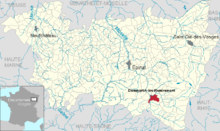
The municipality of Dommartin-lès-Remiremont at the confluence of the Moselotte and Moselle rivers is three kilometers south-east of the town of Remiremont , more spaciously in the south-western Vosges .
The 21.8 km² municipal area of Dommartin-lès-Remiremont extends from the left bank of the Moselotte, which forms the northern municipal border, over the Moselle valley to the mountainous regions on both sides of the Moselle. The Taldreieck at the Moselottemündung is about 500 hectares in size, has a low gradient and is supported by numerous bayous crisscrossed and drainage ditches. The core of the Dommartin settlement was made flood-proof and located a little away from the mouth of the Moselotte and the Moselle. The southwest of the municipality to the right of the Moselle extends to the Rhine-Rhône watershed with heights of up to 740 meters above sea level. The forested southeast half of the community area is also mountainous and reaches the highest point of the community at 842 m on a plateau. In the extreme southeast are the two small mountain lakes Etang de la Besace and Etang le Grand at an altitude of almost 700 meters.
The approximately 390 meters high Moselle valley, like the Moselottetal near Dommartin, is characterized by agricultural land. The settlement area extends in an arch on the edge of the valley and along the connecting roads. The districts of Franould and La Poirie , which belong to Dommartin-lès-Remiremont, have now grown together. The densely forested area in the southeast belongs to the 20 km² Forêt de Longegoutte .
Neighboring municipalities of Dommartin-lès-Remiremont are Saint-Amé in the north, Le Syndicat and Vagney in the east, Vecoux and Rupt-sur-Moselle in the south, Girmont-Val-d'Ajol in the southwest and Saint-Étienne-lès-Remiremont in the west .
history
Dommartin appears for the first time in 1296 in connection with the Ban de Longchamp in a document that belonged to the area of influence of the Remiremont chapter . In addition to the parish of Dommartin, the Ban de Longchamp also included the settlements Franould, Poirie, Vecoux and Reherrey as well as the places in what is now the municipality of Rupt-sur-Moselle.
However, the area was already settled in prehistoric times, which is evident from ax and core finds in 1970 and 1976.
It is said of Ludwig the Pious that he and his entourage hunted in the woods around Dommartin during his stays in Remiremont.
Dommartin already had a parish in the Carolingian era , which was under the Abbey of Remiremont until the French Revolution. The church was originally consecrated to St. Martin ( Dominus Martinus ), which explains the place name Dommartin . The current church building Saint-Laurent dates from the 16th and 17th centuries. Some items such as a statue of the Virgin and Child and relics are from the 15th century.
During the turmoil of the French Revolution, the church was temporarily closed and Dommartin was given the name Martin-Libre . After 1790, the two communities Dommartin and Rupt-sur-Moselle emerged from the Ban Longchamp. In 1858, the southeastern part of the municipality of Dommartin was detached and the municipality of Vecoux was re-established.
Population development
The municipality of Dommartin-lès-Remiremont has grown continuously since the 1960s, in part at the expense of the nearby small town of Remiremont .
| year | 1962 | 1968 | 1975 | 1982 | 1990 | 1999 | 2006 | 2017 | |
|---|---|---|---|---|---|---|---|---|---|
| Residents | 958 | 1156 | 1429 | 1661 | 1763 | 1800 | 1840 | 1894 | |
| Sources: Cassini and INSEE | |||||||||
Attractions
- Saint Laurent Church
- Moselle bridge Le Pont , mentioned as early as 1235
Economy and Infrastructure
In addition to agriculture and forestry, craft, industry and tourism also play a role in the municipality. The community has a bakery, a butcher shop, grocery stores, a cheese dairy and three restaurants. There are 23 farms in the community (cereal and fruit growing, dairy farming, cattle, sheep and goat breeding).
Dommartin is a kindergarten and primary school location.
The heavily frequented Route nationale 66 ( European route 512 ) from Épinal via the Col de Bussang to Mulhouse runs along the left bank of the Moselle, separated from the town center. Dommartin on the right bank of the Moselle is connected by roads to the neighboring communities of Remiremont , Vecoux , Le Syndicat and to Vagney via the 550 meter high Col de Chenau . The street name Rue de la Gare is a reminder of the disused railway lines from Remiremont to Bussang and Vagney .
supporting documents
- ↑ Dommartin-lès-Remiremont on cassini.ehess.fr
- ↑ Dommartin-lès-Remiremont on insee.fr
- ↑ Farms on annuaire-mairie.fr (French)


