
Montmotier
| Montmotier | ||
|---|---|---|
|
||
| region | Grand Est | |
| Department | Vosges | |
| Arrondissement | Epinal | |
| Canton | Le Val-d'Ajol | |
| Community association | Epinal | |
| Coordinates | 47 ° 58 ' N , 6 ° 11' E | |
| height | 247-309 m | |
| surface | 4.24 km 2 | |
| Residents | 45 (January 1, 2017) | |
| Population density | 11 inhabitants / km 2 | |
| Post Code | 88240 | |
| INSEE code | 88311 | |
 Location of the municipality of Montmotier in the Vosges department |
||

Montmotier is a French commune with 45 inhabitants (as of January 1, 2017) in the Vosges department in the Grand Est region . It belongs to the Arrondissement Épinal and the municipal association Épinal .
geography
The municipality of Montmotier is located at an altitude of 340 m above sea level, 9 km southwest of Bains-les-Bains in the extreme south of Lorraine on the border with the Franche-Comté region , more spaciously in the middle of the triangle Vittel - Épinal - Vesoul in the Vôge countryside . The small village lies on the edge of a plateau north of the Côney valley and south of the forest heights of the Grand Bois .
The area of the 4.24 km² municipality covers a section in the undulating landscape east of the upper Saône valley . The southern border is always the Côney, which draws several river loops here and ensures drainage to the southwest to the Saône. The Canal des Vosges waterway runs parallel to the north of the river . In the area of the municipality there are two canal locks (Montmoutier and Gros Moulin), each with a lifting height of 3.10 m. The alluvial valley of the Côney is an average of 250 m and has a maximum width of 300 meters.
The community area extends northward from the river valley over a steep slope to the adjacent agriculturally used plateau, which reaches a height of 290 m. Extensive woodland dominates further north ( Bois de Montroche ), of which the municipality of Montmotier has a share of around 50 hectares. In geological and tectonic terms, the terrain consists of red sandstone from the Lower Triassic . The western boundary to the municipality of Ambiévillers runs partly along the Ruisseau de la Fresse and its tributary Ruisseau du Bon Vin . The valley system flows into the Canal des Vosges in the area of the Gros Moulin lock. The mill weir of the Gros Moulin dams the Côney to a lake of about 5 hectares.
Neighboring communities of Montmotier are Fontenoy-le-Château in the north, east and south and Ambiévillers in the west.
history
The place was long in the area of the Terres surséance , which has been claimed for centuries by the County of Burgundy and the Duchy of Lorraine . From 1508 on, there were several contracts to belong to the area. It was not until the Treaty of Besançon between Louis XIV and Duke Leopold of Lorraine , signed on August 25, 1704, that the border was finally determined. Montmotier came to Lorraine with a few other villages, while Fougerolles became French.
Population development
With 45 inhabitants (January 1, 2017), Montmotier is one of the smallest communities in the Vosges department. Since the 1970s, only relatively minor fluctuations have been recorded.
| year | 1962 | 1968 | 1975 | 1982 | 1990 | 1999 | 2007 | 2017 | |
| Residents | 70 | 81 | 49 | 52 | 62 | 59 | 55 | 45 | |
| Sources: Cassini and INSEE | |||||||||
Attractions
Local attractions include a Calvaire in the 18th century, a Lavoir , which once served as well, wash and cattle trough and a water tower.
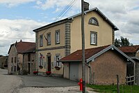
town hall

Water tower

Lavoir


Economy and Infrastructure
The few employed Montmotiers are employed in agriculture and small service companies in the village or the surrounding area. There is a livestock farm in the community.
The community does not have its own church. The church of Saint Mansuy in the neighboring parish of Fontenoy-le-Château is responsible for pastoral care .
The D 434 trunk road from Épinal via Xertigny , Bains-les-Bains and Vauvillers to Vesoul is the main road through Montmotier. The nearest train station (Bains-les-Bains) is ten kilometers east of Montmotier.
supporting documents
- ↑ Montmotier on vosges-archives.com ( Memento of the original from December 8, 2015 in the Internet Archive ) Info: The archive link has been inserted automatically and has not yet been checked. Please check the original and archive link according to the instructions and then remove this notice. (PDF file, French; 18 kB)
- ↑ Montmotier on cassini.ehess.fr
- ↑ Montmotier on insee.fr
- ↑ Farm on annuaire-mairie.fr (French)