
Destord
| Destord | ||
|---|---|---|

|
|
|
| region | Grand Est | |
| Department | Vosges | |
| Arrondissement | Epinal | |
| Canton | Bruyères | |
| Community association | Bruyères-Vallons des Vosges | |
| Coordinates | 48 ° 16 ' N , 6 ° 37' E | |
| height | 311-364 m | |
| surface | 5.04 km 2 | |
| Residents | 256 (January 1, 2017) | |
| Population density | 51 inhabitants / km 2 | |
| Post Code | 88600 | |
| INSEE code | 88130 | |
 Town hall and school building |
||

Destord is a French commune with 256 inhabitants (as of January 1, 2017) in the Vosges department in the Grand Est region , it belongs to the Épinal arrondissement , the Bruyères canton and the Bruyères-Vallons des Vosges municipal association, which was newly formed in 2014 . Before 2014, Destord was a member of the L'Arentèle-Durbion-Padozel community association .
geography

The municipality of Destord is located about 20 kilometers northeast of Épinal on a side stream of the Arentèle . The neighboring municipalities are Sainte-Hélène , Pierrepont-sur-l'Arentèle , Nonzeville , Gugnécourt , Girecourt-sur-Durbion , Padoux and Bult .
Population development
| year | 1962 | 1968 | 1975 | 1982 | 1990 | 1999 | 2006 | 2017 | |
|---|---|---|---|---|---|---|---|---|---|
| Residents | 137 | 128 | 105 | 181 | 222 | 205 | 231 | 256 | |
| Sources: Cassini and INSEE | |||||||||
Attractions
- Saint-Remy church

Exterior view

inside view
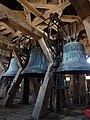
Bells


Economy and Infrastructure
There are seven farms in the municipality (breeding cattle, sheep, goats and poultry).
The D 159 from Girecourt-sur-Durbion to Rambervillers runs through the municipality of Destord . In the town of Épinal , 20 kilometers away, there is a connection to the motorway-like RN 57 from Nancy to Remiremont . Bruyères station, twelve kilometers from Destord, is on the Arches – Saint-Dié railway line .