
Pallegney
| Pallegney | ||
|---|---|---|
|
||
| region | Grand Est | |
| Department | Vosges | |
| Arrondissement | Epinal | |
| Canton | Bruyères | |
| Community association | Epinal | |
| Coordinates | 48 ° 18 ' N , 6 ° 27' E | |
| height | 297-350 m | |
| surface | 5.93 km 2 | |
| Residents | 170 (January 1, 2017) | |
| Population density | 29 inhabitants / km 2 | |
| Post Code | 88330 | |
| INSEE code | 88342 | |
 Location of Pallegney in the Vosges department |
||

Pallegney is a French commune with 170 inhabitants (January 1, 2017) in the Vosges department in the Grand Est region ( Lorraine until 2015 ). It belongs to the Arrondissement Épinal , the canton Bruyères and since 2012 the municipal association Agglomération d'Épinal .
geography
The municipality of Pallegney is located on the Durbion , a right tributary of the upper Moselle , about ten kilometers north of Épinal .
Neighboring communities of Pallegney are Zincourt in the north, Domèvre-sur-Durbion in the east, Capavenir-Vosges in the south and Vaxoncourt in the west.
Population development
| year | 1962 | 1968 | 1975 | 1982 | 1990 | 1999 | 2007 | 2017 |
| Residents | 130 | 132 | 105 | 158 | 171 | 164 | 162 | 170 |
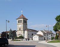
Church of St. Luke

Mairie Pallegney

