La Baffe
| La Baffe | ||
|---|---|---|
|
|
||
| region | Grand Est | |
| Department | Vosges | |
| Arrondissement | Epinal | |
| Canton | Epinal-2 | |
| Community association | Epinal | |
| Coordinates | 48 ° 10 ′ N , 6 ° 34 ′ E | |
| height | 365-489 m | |
| surface | 9.01 km 2 | |
| Residents | 634 (January 1, 2017) | |
| Population density | 70 inhabitants / km 2 | |
| Post Code | 88460 | |
| INSEE code | 88028 | |
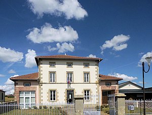
 Mairie La Baffe |
||
La Baffe is a French commune with 634 inhabitants (as of January 1, 2017) in the Vosges department of the Grand Est region (until 2015 Lorraine ). It belongs to the Arrondissement Épinal and the municipal association Épinal .
geography
The municipality of La Baffe is located about nine kilometers southeast of Épinal in the western foothills of the Vosges .
The municipality covers part of the relatively wide central Ruisseau-d'Argent valley, which narrows again towards the southwest towards the Moselle valley . To the northwest, the terrain rises to a distinctive mountain ridge reaching heights of more than 600 m, which extends from the Moselle valley near Épinal to the headwaters of the Arentèle . The lower areas of the 9 km² municipal area up to around 420 meters above sea level are characterized by areas used for settlement and agriculture. The upper layers - roughly correspond to the northwest half of the municipality - are occupied by the Forêt Communale de la Baffe , part of a large contiguous forest area.
La Baffe includes the district of Mossoux as well as the hamlets and individual farms Le Voé, Mignauvoid and Le Pré Ballon .
Neighboring communities of La Baffe are Aydoilles in the north, Charmois-devant-Bruyères in the east, Cheniménil in the south-east, Archettes in the south-west and Épinal in the north-west.
history
La Baffe was on the Roman road from Langres via Bains-les-Bains to Deneuvre an der Meurthe .
The village (still written Labaffe in 1793 ) belonged in the Ancien Régime to the Bailliage Épinal, ecclesiastically to the municipality of Archettes. This only changed in 1847 with the construction of the village church.
Population development
| year | 1962 | 1968 | 1975 | 1982 | 1990 | 1999 | 2007 | 2017 | |
| Residents | 260 | 315 | 313 | 397 | 482 | 562 | 630 | 634 | |
| Sources: Cassini and INSEE | |||||||||
Attractions
- Church of the Assumption ( Église de l'Assomption-de-Notre-Dame ), built in 1847
Economy and Infrastructure
There are seven farms in the municipality (dairy farming, horse breeding). In the last few decades the community has developed into a place of residence for commuters from nearby Épinal. In addition, the community is home to a public kindergarten and a Dominican school for girls.
Départementstrasse 11 from Épinal to Le Tholy (as part of the Épinal- Colmar road ) runs through the municipality of La Baffe. There are further road connections to the neighboring communities of Charmois-devant-Bruyères, Cheniménil and Archettes. Four kilometers southeast of La Baffe is the Cheniménil-Docelles stop on the Arches - Saint-Dié railway line operated by TER Lorraine .
supporting documents
- ↑ La Baffe on vosges-archives.com. (pdf; 115 kB) (No longer available online.) Archived from the original on March 4, 2016 ; Retrieved February 17, 2012 (French). Info: The archive link was inserted automatically and has not yet been checked. Please check the original and archive link according to the instructions and then remove this notice.
- ↑ La Baffe on cassini.ehess.fr
- ↑ La Baffe on insee.fr
- ↑ Farms on annuaire-mairie.fr (French)
- ↑ Dominican School La Baffe (French)


