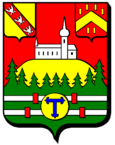
Le Tholy
| Le Tholy | ||
|---|---|---|

|
|
|
| region | Grand Est | |
| Department | Vosges | |
| Arrondissement | Saint-Dié-des-Vosges | |
| Canton | La Bresse | |
| Community association | Hautes Vosges | |
| Coordinates | 48 ° 5 ' N , 6 ° 45' E | |
| height | 484-893 m | |
| surface | 30.76 km 2 | |
| Residents | 1,573 (January 1, 2017) | |
| Population density | 51 inhabitants / km 2 | |
| Post Code | 88530 | |
| INSEE code | 88470 | |
 Mairie Le Tholy |
||
Le Tholy is a French commune with 1,573 inhabitants (as of January 1, 2017) in the Vosges department in the Grand Est region (until 2015 Lorraine ). It belongs to the Arrondissement of Saint-Dié-des-Vosges and the Hautes Vosges municipal association .
geography
The municipality of Le Tholy is located in the Vosges , roughly in the middle of the urban triangle Épinal / Remiremont / Gérardmer .
The municipality of Le Tholy comprises a section of the Cleurietal , which is up to 200 meters wide, as well as the mountain ridges south of the valley, reaching up to 893 meters above sea level, and the mountains around the 827 m high L'Ormont or the 728 m high Roches, which rise north and north-west of the core town de la Moulure . The place Le Tholy stretches from the Cleurie riverbed about 100 meters up a southern slope and is thus visible from afar from the south. More than half of the 30.76 km² community area is forested. These are shares in the large contiguous forests of Bois de la Charme de l'Ormont in the north-west, Forêt de Fossard in the west and Forêt de Housseramont in the south of the municipality. The altitude of the valleys of over 500 meters means that there is hardly any economic arable farming, so cattle pastures dominate in the valley and on the lower slopes. There are also many mountain farms in the higher elevations.
The community is divided into the following residential areas:
- Le Center - the actual town center
- Bonnefontaine - the farms and hamlets north of the Cleurietal
- Bouvacôte - the farms and hamlets south of the Cleurietal
- Le Rain Brice - district on the Cleurie east of the town center
Neighboring municipalities of Le Tholy are Rehaupal in the north, Liézey and Gérardmer in the east, Sapois and Vagney in the south, Le Syndicat , La Forge and Cleurie in the south-west and Tendon in the west and north-west.
history
The name "Le Tholy" could have been derived from the French "tuile" ( brick ) after Célestin Melin , a former teacher and local history researcher from Le Tholy . He justifies this with the earlier existence of a clay kiln near the clay deposits in the Cleurietal.
The community emerged in 1790 from the hamlets and farms around the Ban de Saint-Joseph . Saint-Joseph is the church in Le Tholy, the construction of which goes back in 1663 to the work of Pierre Fourier, who was later canonized . The church burned down in 1730 and was then rebuilt. Representations on the stained glass windows of the church still remember Pierre Fourrier.
Population development
| year | 1962 | 1968 | 1975 | 1982 | 1990 | 1999 | 2007 | 2017 | |
| Residents | 1513 | 1543 | 1552 | 1583 | 1541 | 1556 | 1554 | 1573 | |
| Sources: Cassini and INSEE | |||||||||
The population of the municipality of Le Tholy has remained almost constant since the 1960s.
Attractions
- Saint-Joseph church with a statue of the Virgin Mary from 1760
- Notre Dame du Tholy chapel, completed in 1946
- Waterfalls on the border with the municipality of Tendon ( Grande Cascade, Petite Cascade de Tendon )
Economy and Infrastructure
Le Tholy is now a tourist town with numerous guest houses, hotels and holiday homes. There is also a campsite. The municipality owes this development to its location between the waterfalls of Tendon and the Lac de Gérardmer, as well as its convenient transport links. Le Tholy is also known nationwide for its cheese production - a Caprice des dieux is made here under the umbrella of the Savencia Group. There are 23 farms in the municipality of Le Tholy (cultivation of aromatic plants, dairy farming, horse, cattle, goat, sheep and poultry breeding). Other livelihoods of the residents are pottery and snail breeding . A quarry is operated on the eastern edge of the municipality. Some residents commute to the surrounding industrial communities.
The municipality of Le Tholy is the school location ( L'école du Center ). In Le Tholy there are three butchers, a bakery, a gas station, a grocery store and a florist.
In Le Tholy the trunk road D 11 branches off over the 676 m high Col de Bonnefontaine to Épinal from the trunk road D 417 ( Remiremont - Gérardmer - Colmar ) which crosses the Vosges . There are also road connections to the neighboring communities of Rehaupal and Liézey . The nearest train station is in the town of Remiremont, 16 kilometers away.
Parish partnership
Le Tholy has had a partnership with the Belgian municipality of Onhaye since 1981 .
supporting documents
Web links
- Community homepage (French)
- Population statistics


