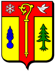
Nompatelize
| Nompatelize | ||
|---|---|---|

|
|
|
| region | Grand Est | |
| Department | Vosges | |
| Arrondissement | Saint-Dié-des-Vosges | |
| Canton | Raon-l'Étape | |
| Community association | Saint-Dié-des-Vosges | |
| Coordinates | 48 ° 20 ′ N , 6 ° 51 ′ E | |
| height | 301-521 m | |
| surface | 6.91 km 2 | |
| Residents | 541 (January 1, 2017) | |
| Population density | 78 inhabitants / km 2 | |
| Post Code | 88470 | |
| INSEE code | 88328 | |
 Mairie Nompatelize |
||
Nompatelize is a French commune with 541 inhabitants (as of January 1, 2017) in the Vosges department in the Grand Est region (until 2015 Lorraine ). It belongs to the Arrondissement of Saint-Dié-des-Vosges and the municipality of Saint-Dié-des-Vosges . The residents call themselves Norpadien (ne) s .
geography
Nompatelize is located in the western foothills of the Vosges , about ten kilometers northwest of Saint-Dié-des-Vosges . The wooded area around Nompatelize rises slightly in a south-westerly direction and reaches average heights of 300 to 350 m above sea level. In the far east, the municipality extends as far as the Meurthe River . The striking conical mountain Le Petit Jumeau ( 521 m ) rises to the south . Nompatelize includes the districts and hamlets of La Grange, La Maie, Biarville and parts of the localities of Les Feignes and Les Jumeaux . Neighboring municipalities of Nompatelize are Étival-Clairefontaine in the north, La Voivre in the east, Saint-Michel-sur-Meurthe in the southeast, La Bourgonce in the southwest, La Salle in the west and Saint-Remy in the northwest.
history
Former names of the village Nompatelize were Nompardi Villa, Nopardi Ecclesia and Nompalteinglise . The village was under the spell of the nearby Etival Abbey with its own parish. In 1594 Nompatelize belonged to the Bailiwick of Nancy and was under the provost of Saint-Dié and the Etival Abbey. In 1751 the village was dependent on the Bailiwick of Saint-Dié and in 1790, at the time the parishes were founded, Nompatelize was part of an urban canton in Saint-Dié. In 1635 and 1636 the village was heavily sacked by Swedish troops and in 1870 by German troops. Ecclesiastically, Nompatelize belonged to the Salm deanery . In 1723, the Etival Abbey donated the funds to build the village church of Saint-Èvre and to build the cemetery. In 1786 the church was reconstructed. The buildings of the Mairie , the boys 'and the girls' school were built in 1883.
Population development
| year | 1962 | 1968 | 1975 | 1982 | 1990 | 1999 | 2006 | 2017 | |
| Residents | 270 | 291 | 319 | 391 | 463 | 522 | 551 | 541 | |
| Sources: Cassini and INSEE | |||||||||
Attractions
- Saint-Èvre church
- Hall crosses
- Fallen memorial at the military cemetery, where 700 French and German dead in the battle of October 6, 1870 during the Franco-Prussian War were buried
Economy and Infrastructure
Ten farms are located in the municipality (grain cultivation, dairy farming, cattle breeding).
The D 32 trunk road runs through the municipality from Rambervillers to Saint-Dié-des-Vosges . Four kilometers east of Nompatelize there is a connection to the motorway-like RN 59 . The station of the neighboring municipality of Saint-Michel-sur-Meurthe is on the railway line from Lunéville to Saint-Dié-des-Vosges.
supporting documents
- ↑ Nompatelize on vosges-archives.com ( Memento of the original from January 26, 2016 in the Internet Archive ) Info: The archive link was automatically inserted and not yet checked. Please check the original and archive link according to the instructions and then remove this notice. , PDF file, French
- ↑ Nompatelize on cassini.ehess.fr
- ↑ Nompatelize on insee.fr
- ↑ Farms on annuaire-mairie.fr (French)


