Alarmont
| Alarmont | ||
|---|---|---|

|
|
|
| region | Grand Est | |
| Department | Vosges | |
| Arrondissement | Saint-Dié-des-Vosges | |
| Canton | Raon-l'Étape | |
| Community association | Saint-Dié-des-Vosges | |
| Coordinates | 48 ° 29 ′ N , 7 ° 1 ′ E | |
| height | 332-813 m | |
| surface | 13.21 km 2 | |
| Residents | 211 (January 1, 2017) | |
| Population density | 16 inhabitants / km 2 | |
| Post Code | 88110 | |
| INSEE code | 88005 | |
 View of Allarmont |
||
Allarmont is a French commune with 211 inhabitants (as of January 1, 2017) in the Vosges department in the Grand Est region (until 2015 Lorraine ). It belongs to the canton of Raon-l'Étape in the arrondissement of Saint-Dié-des-Vosges .
geography
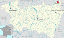
The municipality of Allarmont is located in the Vosges on the left bank of the Plaine . The municipality of Bionville on the opposite bank is part of the Meurthe-et-Moselle department . The area in the Plainetal is dominated by forests, about 200 hectares of which belong to the Allarmont district. The district of La Sciotte in a side valley of the Plaine belongs to Allarmont . The highest point in the municipality is the eastern slope of the Tête de Coquin with 813 m.
Attractions
- Saint-Léonard church
Web links
Commons : Allarmont - collection of images, videos and audio files


