
Saint-Remy (Vosges)
| Saint-Remy | ||
|---|---|---|

|
|
|
| region | Grand Est | |
| Department | Vosges | |
| Arrondissement | Saint-Dié-des-Vosges | |
| Canton | Raon-l'Étape | |
| Community association | Saint-Dié-des-Vosges | |
| Coordinates | 48 ° 21 ′ N , 6 ° 50 ′ E | |
| height | 317-524 m | |
| surface | 12.25 km 2 | |
| Residents | 519 (January 1, 2017) | |
| Population density | 42 inhabitants / km 2 | |
| Post Code | 88484 | |
| INSEE code | 88435 | |

Saint-Remy is a French commune located 350 meters above sea level in the Vosges department in the Grand Est region (until 2015 Lorraine ). It belongs to the canton of Raon-l'Étape in the arrondissement of Saint-Dié-des-Vosges . It is bordered by Etival-Clairefontaine to the north-west, north and north - east, Nompatelize to the south-east, La Salle to the south, Jeanménil to the south-west and Saint-Benoît-la-Chipotte to the west .

Col du Haut de Bois pass
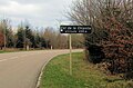
Col de la Chipotte pass

Saint-Remy church


Population development
| year | 1962 | 1968 | 1975 | 1982 | 1990 | 1999 | 2008 | 2014 |
|---|---|---|---|---|---|---|---|---|
| Residents | 317 | 295 | 342 | 360 | 418 | 428 | 505 | 518 |
Web links
Commons : Saint-Remy - collection of images, videos and audio files