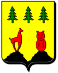
Rochesson
| Rochesson | ||
|---|---|---|

|
|
|
| region | Grand Est | |
| Department | Vosges | |
| Arrondissement | Saint-Dié-des-Vosges | |
| Canton | La Bresse | |
| Community association | Hautes Vosges | |
| Coordinates | 48 ° 1 ' N , 6 ° 47' E | |
| height | 497–1,060 m | |
| surface | 21.49 km 2 | |
| Residents | 699 (January 1, 2017) | |
| Population density | 33 inhabitants / km 2 | |
| Post Code | 88120 | |
| INSEE code | 88391 | |
 Mairie Rochesson |
||
Rochesson is a French commune with 699 inhabitants (January 1, 2017) in the Vosges department in the Grand Est region . It belongs to the Arrondissement of Saint-Dié-des-Vosges and the Hautes Vosges municipal association .
geography
The municipality of Rochesson is located in the Vosges , 15 kilometers east of the city of Remiremont and eleven kilometers southwest of the city of Gérardmer , seen more spaciously between Épinal and Mulhouse , in southeast Lorraine.
The 21.5 km² municipal area of Rochesson includes the catchment area of the Bouchot , a tributary of the Moselotte , except for the upper reaches and the estuary . This includes the valley area formed by a glacier and the parts of the mountainous region extending north and south on both sides of the Bouchot. In the north, a six-kilometer-long, steep mountain ridge, but only 500 to 1000 meters wide, delimits the municipal area from the Menaurupt valley , from the south the mountain streams Goutte du Herray, Goutte de Plainfaing, Goutte de Battion, Goutte de Chercheneux, Goutte lead de Jossonfaing and Ruisseau de Noire Goutte to the Bouchottal. During the time when the snowmelts and / or when there is heavy rainfall, the runoff over the Bouchot can swell to a multiple of normal values. The southwest border of the municipality runs on the ridge of a mountain ridge. Here, the Rocher du Moutiers des Fées, at 1060 meters above sea level, is the highest point in the municipality.
The forests, which cover about 80% of the municipality, belong to the forest areas Forêt de Longegoutte (south of the Bouchot) and Forêt d'Housseramont (north of the Bouchot).
The Bouchottal, which is over 500 meters high (in the area of the district La Cheneau over 600 m), is characterized by a very loosened up development. For climatic reasons, there is no significant arable farming in the valley area, instead meadows and pastures dominate.
Neighboring municipalities of Rochesson are Gérardmer in the northeast, La Bresse in the east, Cornimont and Basse-sur-le-Rupt in the south, Gerbamont in the southwest and Sapois in the west and northwest.
history
The area between Vagney and Gérardmer was slowly settled by clearing from the 7th century. As in the entire Vosges region, monks and the founding of monasteries played a central role. Rochesson was part of the extensive Ban de Vagney , which also included the now independent municipalities of Vagney, Gerbamont , Basse-sur-le-Rupt , Saint-Amé and Saulxures . The Ban de Vagney was half subordinate to the Dukes of Lorraine and half to the Chapter of Remiremont .
As early as 1359 there was a village in the Rochesson area called Aurimont , which was washed away in a devastating flood of the Bouchot in 1522. In 1407 the new village of Rourssechons appears in a document . The name gradually developed from Roschon to Rochesson .
A first chapel in the village has come down to us from 1592. It was destroyed in 1721. Two years later, the current Saint-Blaise church was built on the site. Of the five bells in the tower, the oldest is from 1738.
The mayor's building with the school (Mairie-école) was inaugurated in 1839, the girls' school was built in 1882.
Population development
| year | 1962 | 1968 | 1975 | 1982 | 1990 | 1999 | 2007 | 2016 | |
| Residents | 665 | 701 | 755 | 724 | 627 | 658 | 656 | 698 | |
| Sources: Cassini and INSEE | |||||||||
Attractions
- Church of St. Blaise ( Église Saint-Blaise ), built in 1723
- Panoramic view of the 1060 m high Rondfaing , the southernmost point of the municipality
- St. Blaise Church in Rochesson
Economy and Infrastructure
Smaller craft, trade and construction companies are based in Rochesson (including butcher, bakery and cheese dairy, as well as two car dealerships). In recent years, the tourist offers in Rochesson have been significantly expanded. Numerous holiday homes and guest houses were built. The Vagney-Rochesson Ski Club looks after around ten kilometers of cross-country trails in winter.
The only road through Rochesson that is open all year round (D23) leads from Vagney up the Bouchottal valley to Gérardmer . In Saint-Étienne-lès-Remiremont, 18 kilometers to the west, there is a connection to the Route nationale 66, which is partly developed like a motorway .
partnership
Rochesson has a parish partnership with Mégrit in the French region of Brittany .
supporting documents
- ↑ Brief history on rochesson.free.fr (French)
- ↑ Rochesson on cassini.ehess.fr
- ↑ Rochesson on insee.fr
- ↑ 10 accommodation providers on annuaire-mairie.fr (French)
Web links
- Community presentation ( French )
- Population statistics


