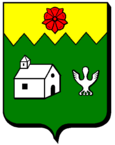
La Chapelle-devant-Bruyères
| La Chapelle-devant-Bruyères | ||
|---|---|---|

|
|
|
| region | Grand Est | |
| Department | Vosges | |
| Arrondissement | Saint-Dié-des-Vosges | |
| Canton | Gerardmer | |
| Community association | Saint-Dié-des-Vosges | |
| Coordinates | 48 ° 11 ' N , 6 ° 47' E | |
| height | 447-768 m | |
| surface | 20.23 km 2 | |
| Residents | 576 (January 1, 2017) | |
| Population density | 28 inhabitants / km 2 | |
| Post Code | 88600 | |
| INSEE code | 88089 | |
 Location of the commune of La Chapelle-devant-Bruyères in the Vosges department |
||
La Chapelle-devant-Bruyères is a French commune in the Vosges department in the region of Grand Est (2015 Lorraine ). It belongs to the arrondissement of Saint-Dié-des-Vosges and to the municipal association of Saint-Dié-des-Vosges, founded in 2017 .
geography
The municipality of La Chapelle-devant-Bruyères, with 576 inhabitants (January 1, 2017), is located between Épinal and Saint-Dié in the Vosges Mountains .
In the municipality, the L'Bheumey flows into the Neuné , which flows over the Vologne to the Moselle . The valley floor, which is around 450 meters above sea level, is lined with some striking mountains. The highest is Mont Moyennel, which measures 768 m . The municipality has shares in extensive forest areas: in the south on the Forêt domaniale de Vologne , in the north on the Forêt communale de Bruyères .
La Chapelle includes the districts of Ivoux and Saint-Jacques, which is adjacent to Vienville .
Neighboring municipalities of La Chapelle-devant-Bruyères are Les Poulières and Biffontaine in the north, La Houssière in the east, Vienville , Corcieux , Arrentès-de-Corcieux and Barbey-Seroux in the southeast, Granges-sur-Vologne in the south, Aumontzey in the southwest, Laveline -devant-Bruyères in the west and Bruyères and Belmont-sur-Buttant in the north-west.
history
In 1867 there were 880 hectares of arable land, 523 hectares of meadows, 290 hectares of forest, 56 hectares of garden land, 69 hectares of fallow land in the municipality of La Chapelle. The most important crops at that time were wheat, barley, oats and potatoes. Outside of agriculture, there were few job opportunities (limestone quarry, starch production, sawmill and mill).
Population development

| year | 1962 | 1968 | 1975 | 1982 | 1990 | 1999 | 2007 | 2016 | |
| Residents | 454 | 506 | 548 | 609 | 633 | 611 | 622 | 586 | |
| Sources: Cassini and INSEE | |||||||||
Attractions
- Parish Church of Sainte-Menne
- Church of Saint-Jacques in the hamlet of Saint-Jacques from the 11th and 12th centuries, Monument historique
Economy and Infrastructure
There are still five farms in the community, either full-time or part-time. In addition to small businesses, industry (including textile coating) is also playing an increasing role, which has settled in two commercial areas ( ZA du Moulin, ZA de la Gare ).
Transport links
The commune of La Chapelle-devant-Bruyères is located on the departmental road D60, which leads from Bruyères via Corcieux to Anould . This road is also the shortest connection from Épinal to the Col du Bonhomme in the Vosges . The Arches - Saint-Dié railway runs through La Chapelle without stopping. The next stops are in the neighboring communities of Laveline-devant-Bruyères and Biffontaine .
supporting documents
- ↑ La Chapelle-devant-Bruyères on cassini.ehess.fr
- ↑ La Chapelle-devant-Bruyères on insee.fr
- ↑ Entry on culture.gouv.fr. Retrieved December 13, 2010 (French).
- ↑ agriculture.118000.fr. Retrieved December 14, 2010 (French).


