Anould
| Anould | ||
|---|---|---|

|
|
|
| region | Grand Est | |
| Department | Vosges | |
| Arrondissement | Saint-Dié-des-Vosges | |
| Canton | Gerardmer | |
| Community association | Saint-Dié-des-Vosges | |
| Coordinates | 48 ° 11 ' N , 6 ° 57' E | |
| height | 419-933 m | |
| surface | 24.23 km 2 | |
| Residents | 3,369 (January 1, 2017) | |
| Population density | 139 inhabitants / km 2 | |
| Post Code | 88650 | |
| INSEE code | 88009 | |
 City Hall Anould |
||
Anould is a French commune with 3369 inhabitants (as of January 1, 2017) in the Vosges department in the Grand Est region . It belongs to the Arrondissement of Saint-Dié-des-Vosges and the municipality of Saint-Dié-des-Vosges .
geography
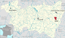
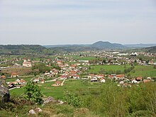
The Vosges community of Anould is located on the upper Meurthe , between the towns of Saint-Dié-des-Vosges and Gérardmer . Coming from the south, the partially canalized Ruisseau de l'Anoux flows through the municipality before it flows into the Meurthe, whose valley in the Anould area is 1000 to 1500 meters wide. The valleys of Meurthe and Anoux are flanked by wooded heights that rise about 150 meters above the river plain. The highest mountain in the Anoulds area is a 936 m high elevation in the so-called Roche des Fées in the southeast of the municipality.
The forest area of the municipality of Anould (including the Forêt communale d'Anould in the north-west) is 962 hectares, which corresponds to a total of almost 40% of the municipal area. In the northern valley area of the municipality there is a modest amount of arable farming, on the mountain slopes there is pastureland.
Anould includes the districts and hamlets of Gerhaudel, L'Anoux, Le Pair, Le Meix Thonon, Venchères, Sondreville, Les Granges, Dévelines, Les Chalets Eden, Le Plafond, Le Souche, Chalgoutte and Xaingoutte .
Neighboring municipalities of Anould are Saint-Léonard in the north, Mandray in the northeast, Fraize in the east, Ban-sur-Meurthe-Clefcy in the southeast, Gerbépal in the south, Corcieux in the southwest and La Houssière in the northwest.
history
In the originally dense, contiguous forest areas of the high Vosges, monks began clearing in the Middle Ages, which the settlers later continued. So many small, secluded mountain farms have sprung up in the area of today's municipality.
There are two theories about the origin of the name Anould , which developed from Annoux (later Aunoulf ). The version of the origin from the Latin anoldium (= knot) is supported by the assumption that the individual hamlets were previously connected by paths that converged at the point of today's town center. A second variant is the origin of the Latin Alnus , French: Aulne (= alder) , a typical tree on river banks.
The oldest documented mention of Anould comes from the year 1225. For 1395 an agreement between the Duke of Lorraine and the Chapter of Saint-Dié on the grazing areas in and around Anould has come down to us. In 1594 Anould was part of the Bailiwick of Nancy and the Provosty of Saint-Dié-des-Vosges.
In 1751 the ban Anould consisted of the hamlets of L'Anoux, La Hardalle, Déveline, Les Granges, Chalgoutte, Les Gouttes, Braconcel, Sainte-Marguerite, Le Paire, Gérhaudel, Le Souche and part of the Vic . In 1801 the parish was still spelled Arnould .
After restructuring as a result of the French Revolution, Anould belonged to the Saint-Dié district and the Saint-Léonard canton from 1790. In 1845, before the start of industrialization, Anould had 2532 inhabitants, who received their income mainly from agriculture (cultivation of hay, rye, oats, potatoes, hemp, flax and buckwheat).
Saint-Antoine church
The church building, already dilapidated in 1789, was no longer renovated because of the high costs. Instead it was decided to build a new church. A slightly elevated plateau was chosen as the location so that the church can be seen from all points of the village. The foundation stone was laid in 1828 and the church was consecrated in 1841. On November 21, 1944, the church was blown up by the Germans during the fighting in retreat for no reason. In the 1960s the church was rebuilt in the same place.
Population development
As one of the few communities on the west side of the Vosges, Anould has been able to record a steady increase in population since 1962.
| year | 1962 | 1968 | 1975 | 1982 | 1990 | 1999 | 2007 | 2017 | |
| Residents | 2457 | 2642 | 2700 | 2885 | 2960 | 2992 | 3261 | 3369 | |
| Sources: Cassini and INSEE | |||||||||
Economy and Infrastructure
Agriculture today only plays a subordinate role in the upper Meurthe region. There are 22 farms in the community (cereal, vegetable and fruit growing, beekeeping, dairy farming, horse and cattle breeding). Due to the abundance of forests in the Vosges, forestry and the wood and paper industry have a long tradition. In the north of the municipality, three industrial areas (industrial zone) were set up, to which workers from neighboring municipalities also commute ( ZI Gerhaudel, ZI des Grands Prés, ZI le Souche ). Industrial companies based in Anould include:
- AROP - machine and device construction
- adapac - paper-based packaging material
- Escaland - stair construction
education
Anould is the location of two public primary schools ( École de la Hardalle, École du Souche ).
Transport links
The RN 415 runs through Anould from Saint-Dié-des-Vosges over the nearby Col du Bonhomme to Colmar . In the village, the D 8 trunk road branches off to Gérardmer over the 620 meters high Col du Plafond , it creates a cross connection to the RN 417 ( Remiremont - Col de la Schlucht -Colmar). There is a rail connection in the northern neighboring municipality of Saint-Léonard , whose station is on the Arches – Saint-Dié railway line .
Parish partnership
Anould maintains a community partnership with the Hessian Schöneck .
supporting documents
- ↑ toponym on cassini.ehess.fr
- ↑ Anould on vosges-archives.com ( Memento of the original from January 15, 2016 in the Internet Archive ) Info: The archive link was inserted automatically and has not yet been checked. Please check the original and archive link according to the instructions and then remove this notice. , French, PDF file
- ↑ Anould on cassini.ehess.fr
- ↑ Anould on insee.fr
- ↑ Farms on annuaire-mairie.fr (French)


