Rehabilitation center
| Rehabilitation center | ||
|---|---|---|
|
|
||
| region | Grand Est | |
| Department | Vosges | |
| Arrondissement | Saint-Dié-des-Vosges | |
| Canton | Bruyères | |
| Community association | Hautes Vosges | |
| Coordinates | 48 ° 7 ' N , 6 ° 44' E | |
| height | 474-763 m | |
| surface | 4.72 km 2 | |
| Residents | 211 (January 1, 2017) | |
| Population density | 45 inhabitants / km 2 | |
| Post Code | 88640 | |
| INSEE code | 88380 | |
 Location of the municipality of Rehaupal in the Vosges department |
||
Rehaupal is a French commune with 211 inhabitants (January 1, 2017) in the Vosges department in the Grand Est region ( Lorraine until 2015 ). It belongs to the Arrondissement of Saint-Dié-des-Vosges and the Hautes Vosges municipal association .
geography
The municipality of Rehaupal is located in the Vosges , about 13 kilometers northwest of the city of Gérardmer .
The 4.72 km² municipal area of Rehaupal extends along the upper valley of the Vologne tributary Barba to its source over a length of about six kilometers. The Barba takes on several mountain streams, including the Ruisseau de Christele Pierre and the Ruisseau des Spaxes . The latter expands the Barbatal to a width of approx. 400 meters at its mouth. Here lies the nucleus and today's center of Rehaupal.
About 40% of the community area is forested, especially the areas over 600 meters in the north and south-east. The altitude of the valley areas of over 480 meters means that there is hardly any economic arable farming, which is why pastures dominate the valleys and on the lower slopes.
Rehaupal's neighboring communities are Champdray in the northeast and east, Liézey in the southeast, Le Tholy in the south, Tendon in the west and Laveline-du-Houx in the northwest.
history
The place name Raihaupaulz has been handed down from the 14th century . The village belonged to the Remiremont chapter , the residents were parish in the neighboring parish of Champdray until the construction of the Saint Pierre church.
In 1793 the municipality still had the spelling Rehanpal . In 1836 the municipality of Rehaupal lost part of its territory to the newly founded municipality of Liézey.
Population development
| 1962 | 1968 | 1975 | 1982 | 1990 | 1999 | 2006 | 2017 | ||
| 203 | 204 | 171 | 179 | 163 | 188 | 183 | 211 | ||
| Sources: Cassini and INSEE | |||||||||
Attractions

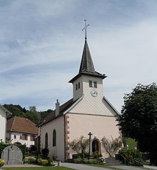
- 19th century church Saint-Pierre
- former water mill, now a hostel
Economy and Infrastructure
Rehaupal is now a tourist resort with guest houses and holiday homes. The municipality owes this development to its location near the waterfalls of Tendon and the Lac de Gérardmer as well as the convenient transport links to the city of Gérardmer . In addition, there are seven farms in the municipality (cereal cultivation, dairy farming).
Rehaupal is five kilometers from the departmental road 417 ( Remiremont - Gérardmer - Colmar ) that crosses the Vosges . The main road in Rehaupal follows the valley of the Barba and connects the municipality with Le Tholy and Laveline-du-Houx . The nearest train station is in the municipality of Lépanges-sur-Vologne, nine kilometers away .
supporting documents
- ↑ Rehaupal on vosges-archives.com ( Memento of the original from March 4, 2016 in the Internet Archive ) Info: The archive link was inserted automatically and has not yet been checked. Please check the original and archive link according to the instructions and then remove this notice. (French)
- ↑ Place name on cassini.ehess.fr
- ↑ Rehaupal on cassini.ehess.fr
- ↑ Rehabilitation center on insee.fr
- ↑ Farms on annuaire-mairie.fr (French)

