
Jarménil
| Jarménil | ||
|---|---|---|
|
||
| region | Grand Est | |
| Department | Vosges | |
| Arrondissement | Epinal | |
| Canton | Remiremont | |
| Community association | Epinal | |
| Coordinates | 48 ° 7 ' N , 6 ° 34' E | |
| height | 352-647 m | |
| surface | 5.10 km 2 | |
| Residents | 474 (January 1, 2017) | |
| Population density | 93 inhabitants / km 2 | |
| Post Code | 88550 | |
| INSEE code | 88250 | |
 Location of the commune of Jarménil in the Vosges department |
||

Jarménil is a French commune with 474 inhabitants (as of January 1, 2017) in the Vosges department in the Grand Est region . It belongs to the Arrondissement Épinal and the municipal association Épinal .
geography
Jarménil between the towns of Épinal and Remiremont in southeast Lorraine lies at the confluence of the 50-kilometer-long Vologne , which rises from the Vosges ridge , and the Moselle .
The municipality of Jarménil extends from the right bank of the upper Moselle, which also forms the southwestern municipal boundary, over both sides of the lower Volognetal up to the 300 meters above the Moselle valley east of the core town. They belong to the westernmost foothills of the Vosges and are almost completely covered by forest ( Les Grandes Hayes ).
The settlement area is limited to the valley locations on the Moselle and Vologne. There is also a modest amount of arable and meadow areas. 80% of the municipality consists of forests.
Neighboring municipalities of Jarménil are Cheniménil in the northeast, Xamontarupt in the east, Éloyes in the southeast, Pouxeux in the south and west and Archettes in the northwest.
history
Before the French Revolution , Jarménil was under the spell of Arches and was long owned by the abbesses of the Chapitre de Remiremont . From 1790 to 1801 the place was part of the canton of Éloyes.
Jarménil has no church. The pastoral care is taken over by the church of Saints-Gorgon-et-Nabor in neighboring Pouxeux .
Population development
The designation of a building area in the 1990s attracted young families in particular from the cities in the vicinity to the community, so that the number of inhabitants increased by 20% compared to the long-term average.
| year | 1962 | 1968 | 1975 | 1982 | 1990 | 1999 | 2006 | 2017 | |
|---|---|---|---|---|---|---|---|---|---|
| Residents | 356 | 362 | 353 | 355 | 342 | 423 | 425 | 474 | |
| Sources: Cassini and INSEE | |||||||||
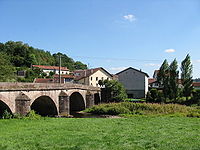
Bridge over the Vologne in Jarménil

Municipal administration and school in Jarménil


Economy and Infrastructure
As in the other municipalities between Épinal and Remiremont, agriculture and forestry play only a subordinate role today. There are four livestock farms in the municipality. In addition to a small sawmill, smaller craft and trading companies have settled in Jarménil. Most of the workers, however, commute to the numerous industrial areas in the neighboring communities in the Moselle valley.
The D 42 from Épinal to Éloyes and the D 159bis from Pouxeux through the Volognetal to Cheniménil run through Jarménil parallel to the Moselle . The Arches – Saint-Dié railway also crosses the area of the municipality, but there is no boarding option. The next stop is Pouxeux on the Épinal – Bussang railway line following the Moselle valley , which is also operated by the TER Lorraine company.