Archettes
| Archettes | ||
|---|---|---|

|
|
|
| region | Grand Est | |
| Department | Vosges | |
| Arrondissement | Epinal | |
| Canton | Epinal-2 | |
| Community association | Epinal | |
| Coordinates | 48 ° 7 ' N , 6 ° 32' E | |
| height | 338-507 m | |
| surface | 13.93 km 2 | |
| Residents | 1,085 (January 1, 2017) | |
| Population density | 78 inhabitants / km 2 | |
| Post Code | 88380 | |
| INSEE code | 88012 | |
 Mairie Archettes |
||
Archettes is a French commune with 1,085 inhabitants (as of January 1, 2017) in the Vosges department in the Grand Est region (until 2015 Lorraine ). It belongs to the Arrondissement Épinal and the municipal association Épinal .
geography
Archettes is located on the upper Moselle , seven kilometers southeast of Épinal .
The municipality of Archettes encompassing almost 14 km² extends from the right bank of the Moselle, which also forms the southern and western municipal boundaries, to the heights on both sides of the Ruisseau d'Argent ( Silberbach ), which crosses the municipal area from northeast to southwest and into the Moselle flows into it. The Moselle valley in the area of Archettes is about 350 meters above sea level, at the northernmost point of the municipal area the maximum height is reached at 507 meters above sea level, which is in the 100 ha part of the municipality of the 50 km² Forêt communale d'Épinal . The east of the community is also dominated by forests: here it is the 4 km² Forêt domaniale de Tannières .
With the exception of a few mountain farms, the settlement area is limited to the valley areas on the Moselle and Ruisseau d'Argent. Arable and meadow areas make up about half of the municipal area. The districts and hamlets of Le Bois Formé, Mont le Rupt, L'Eremitage, Ancienne Tissage Sarrazin, Cense des Arpents and La Goutte belong to Archettes . Neighboring municipalities of Archettes are Épinal and La Baffe in the north, Cheniménil in the east, Jarménil and Pouxeux in the southeast and Arches in the south and west.
history
The name affinity with the neighboring municipality of Arches on the opposite bank of the Moselle is striking. The common origin is probably the Latin arculae , which can be translated as arches / gates. Meant are the arches of the Moselle bridge, which connects the two places with each other. It is assumed that a previous bridge from Gallo-Roman times must have existed.
Before the French Revolution, the Silberbach (Ruisseau d'Argent) separated the settlement area into two parts that were subject to different jurisdictions. The area to the left or east of the Silberbach was under the Arches ban and was under the Bailiwick of Remiremont . To the west or to the right of the brook began the sphere of influence of the baillage ( ballei ) of Épinal . The separation continued even after the community was founded in the area of forest use, only in 1897 the problems were resolved with the creation of the Forêt domaniale de Tannières .
The Saint-Léger church ( consecrated to Léger d'Autun ) was completely overhauled in the 19th century. The inventory includes a 16th century Madonna and Child , which came from a former Épinal monastery. Parts of the altar and candle holders come from a local chapel that was destroyed in 1789.
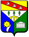
The Archettes coat of arms documents the various aspects of the past and present of the community: the arched bridge over the Moselle, the abundance of forests, the water power that once powered paper mills and the remains of a Gallo-Roman temple of Mercury.
Archettes was liberated by the Americans on September 22nd, 1944, and a memorial service is held in the town every September 22nd.
Population development
| year | 1962 | 1968 | 1975 | 1982 | 1990 | 1999 | 2007 | 2017 | |
| Residents | 883 | 949 | 1015 | 1072 | 1038 | 1026 | 1084 | 1085 | |
| Sources: Cassini and INSEE | |||||||||
Attractions
- Saint-Léger church
- Oak of the Virgin in the Forêt domaniale de Tannières, here a mass takes place every August 15th
- Remains of a Gallo-Roman sanctuary in the Forêt domaniale de Tannières
- Fallen memorial
Economy and Infrastructure
Forestry and agriculture still play a role in Archettes today. There are seven farms in the municipality (potato growing, dairy farming, cattle breeding). In addition, smaller handicraft and trading companies have settled here, including handicrafts in the field of porcelain and tile decoration. Many employed people commute to the numerous industrial parks in neighboring communities in the Moselle valley.
Archettes is a primary school and kindergarten location.
The D 42 trunk road from Épinal to Éloyes runs through Archettes parallel to the Moselle . In Arches on the opposite side of the Moselle there is a connection to the two-lane national road 57 (Épinal- Remiremont ) and the railway lines Nancy- Épinal-Remiremont and Épinal- Saint-Dié-des-Vosges - Strasbourg .


