Le Ménil
| Le Ménil | ||
|---|---|---|

|
|
|
| region | Grand Est | |
| Department | Vosges | |
| Arrondissement | Epinal | |
| Canton | Le Thillot | |
| Community association | Balloons of the Hautes-Vosges | |
| Coordinates | 47 ° 54 ' N , 6 ° 47' E | |
| height | 509-1,106 m | |
| surface | 20.38 km 2 | |
| Residents | 1,069 (January 1, 2017) | |
| Population density | 52 inhabitants / km 2 | |
| Post Code | 88160 | |
| INSEE code | 88302 | |
 Mairie Le Ménil |
||
Le Ménil is a French commune with 1,069 inhabitants (as of January 1, 2017) in the Vosges department of the Grand Est region . It is part of the Épinal arrondissement and the Ballons des Hautes-Vosges municipal association .
geography
The municipality of Le Ménil is located in the Vosges in south-east Lorraine. The towns of Remiremont and Gérardmer are each 30 kilometers from Le Ménil.
The municipality of Le Ménil extends over the wide high valley of the Ruisseau du Ménil river , a tributary of the upper Moselle , up to the heights east of the village, which come close to the main ridge of the Vosges. In the northeast corner of the municipality, the highest point is reached at 1108 meters above sea level. The valley of the Ruisseau du Ménil runs parallel to the Vosges ridge and across the valleys of the Moselle and Moselotte , it represents a natural transition between the two main valleys. The saddle of the Col du Ménil at 621 meters leads to the valley of the Ruisseau de Travexin , which continues the valley direction of the Ruisseau du Ménil. The Ménil valley is flanked in the west by steeply rising wooded heights, while to the east the area rises more gently.
Over a third of the 20 km² municipal area is covered with forests that belong to the forest areas Forêt Domaniale du Géhant, Forêt du Bonhomme and Bois de Maxéromont . Since the lower elevations in the municipality are over 500 meters above sea level, economic farming is not possible, so that in the valleys there are meadows and pastures that occasionally extend into the higher mountain regions.
The built-up settlement area is widely scattered, only in the area around the church and in the Demrupt district the development appears a bit denser.
Neighboring municipalities of Le Ménil are Saulxures-sur-Moselotte and Cornimont in the north, Ventron in the northeast, Bussang in the east, Fresse-sur-Moselle and Le Thillot in the south and Ramonchamp in the west.
history
Until the French Revolution, the scattered settlement structure of the Ban de Ramonchamp belonged to the abbesses of the Chapitre de Remiremont . Today's community was created in 1735 when the hamlets in the upper Ménil valley were combined.
Until the middle of the 19th century, the inhabitants lived from agriculture and livestock farming, and the farmers also earned their living as lumberjacks, craftsmen, joiners, clog makers and team leaders.
Around 1830, the structure of employment in Le Ménil changed when small spinning and weaving mills were established. After the Franco-Prussian War of 1870/1871, the textile industry experienced a new, increased boom through the settlement of Alsatian companies who had fled the Germans. A hand spindle in the municipality's coat of arms reminds of the time of the textile industry .
The textile industry began to decline in the 1970s. New jobs could only be created gradually.
Population development
| year | 1962 | 1968 | 1975 | 1982 | 1990 | 1999 | 2006 | 2017 | |
|---|---|---|---|---|---|---|---|---|---|
| Residents | 678 | 870 | 826 | 1067 | 1119 | 1117 | 1180 | 1069 | |
| Sources: Cassini and INSEE | |||||||||
Attractions
- Saint-Blaise church from 1733
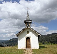
- two mountain chapels ( Chapelle de Salette, Chapelle de la Pitié )
Economy and Infrastructure
Only a few residents of Le Ménil are still employed in agriculture and forestry. There are 14 farms in the community (vegetable growing, beekeeping, dairy farming, breeding of cattle, sheep and goats). Plastics and metal processing companies have settled in the ZAC (Zone d'aménagement concerté) le Prey industrial estate, which is located immediately south of Le Ménil . With the designation and construction of numerous holiday homes and the creation of a caravaning campsite, tourism plays the most important role in Le Ménil today.
The D 486 trunk road (formerly Route nationale 486 ) leads from Lure via Le Ménil and the Col du Ménil to Gérardmer and crosses the Vosges valleys, which run in an east-west direction. The closest municipalities with a rail connection are Remiremont and Fellering .


