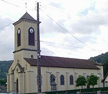
Ferdrupt
| Ferdrupt | ||
|---|---|---|
|
|
||
| region | Grand Est | |
| Department | Vosges | |
| Arrondissement | Epinal | |
| Canton | Le Thillot | |
| Community association | Balloons of the Hautes-Vosges | |
| Coordinates | 47 ° 54 ' N , 6 ° 43' E | |
| height | 444-903 m | |
| surface | 14.60 km 2 | |
| Residents | 721 (January 1, 2017) | |
| Population density | 49 inhabitants / km 2 | |
| Post Code | 88360 | |
| INSEE code | 88170 | |
 Mairie Ferdrupt |
||
Ferdrupt is a French commune with 721 inhabitants (as of January 1, 2017) in the Vosges department of the Grand Est region . It is part of the Épinal arrondissement and the Ballons des Hautes-Vosges municipal association .
geography
The municipality of Ferdrupt on the upper Moselle is located in the Vosges Mountains in the extreme southeast of Lorraine and borders the Bourgogne-Franche-Comté region in the south . The next larger town, Remiremont, is 18 kilometers away.
The municipality of Ferdrupt stretches from the valley of the Moselle , which is about 500 meters wide here, to the ridge slopes north and south of the village. In the north, at 903 meters, the highest point in the municipality is reached. In the south, at a maximum height of 765 meters, there is a transition to a high plateau that forms the watershed to the Saône catchment area . In the municipal area, two mountain streams, whose valleys cut deep into the mountains, flow into the Moselle: from the north the Ruisseau de Ferdrupt , from the south the Ruisseau de Xoarupt .
Three quarters of the 14.6 km² municipal area is covered by forest, which belongs to the forest areas Forêt Domaniale du Géhant, Forêt Domaniale de Longegoutte and Bois du Ménil . The narrow Moselle valley allows only narrow arable land, on the lower mountain slopes, pastures dominate.
The districts Remanvillers and Xoarupt belong to Ferdrupt .
Ferdrupt's neighboring communities are Saulxures-sur-Moselotte in the north, Ramonchamp in the east, Beulotte-Saint-Laurent in the south, Corravillers in the southwest and Rupt-sur-Moselle in the west.
history
Already in Roman times the route from Metz to Basel led over the upper Moselle valley and thus through Ferdrupt. Lead, copper and silver were mined near the town well into the 20th century.
The municipality of Ferdrupt was created in 1832 from parts of today's neighboring municipalities of Rupt-sur-Moselle and Ramonchamp.
Population development
| year | 1962 | 1968 | 1975 | 1982 | 1990 | 1999 | 2006 | 2017 | |
| Residents | 720 | 790 | 763 | 833 | 859 | 854 | 810 | 721 | |
| Sources: Cassini and INSEE | |||||||||
Economy and Infrastructure
Only a few residents of Ferdrupt are still employed in agriculture and forestry. Ten farms are located in the municipality (breeding of grass fowl, cattle, sheep and goats). In addition to the hospitality industry (boarding houses in winter sports areas), the textile industry plays a role ( Kohler France Textiles SA ). In addition, many residents of the upper Moselle valley commute to the industrial areas around Remiremont .
The heavily frequented Route nationale 66 ( E 512 ) from Épinal over the Col de Bussang to Mulhouse leads through Ferdrupt. In 2008 it was completely renovated in the local area.


