Juvaincourt
| Juvaincourt | ||
|---|---|---|

|
|
|
| region | Grand Est | |
| Department | Vosges | |
| Arrondissement | Epinal | |
| Community association | Mirecourt Dompaire | |
| Coordinates | 48 ° 20 ' N , 6 ° 4' E | |
| height | 293-348 m | |
| surface | 8.82 km 2 | |
| Residents | 184 (January 1, 2017) | |
| Population density | 21 inhabitants / km 2 | |
| Post Code | 88500 | |
| INSEE code | 88257 | |
 Location of the municipality of Juvaincourt in the Vosges department |
||
Juvaincourt is a French commune with 184 inhabitants (January 1, 2017) in the Vosges department in the Grand Est region . It belongs to the Arrondissement Épinal and the municipal association Mirecourt Dompaire .
geography
The municipality of Juvaincourt is 40 kilometers south of Nancy and 40 kilometers northwest of Épinal .
Through the flat, undulating terrain The Ruisseau d'Oëlleville flows through the municipality and flows into the Moselle tributary Madon .
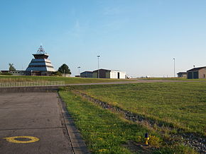
The proportion of forest in the community is around one eighth, half of the community area consists of arable land and grassland. The southern third of the municipal area occupies the site of the Épinal-Mirecourt airport , which is operated by the Chamber of Commerce and Industry of the Vosges department ( Chambre de commerce et d'industrie des Vosges ).
Neighboring communities of Juvaincourt are Frenelle-la-Petite in the north, Puzieux in the east, Domvallier in the southeast, Baudricourt in the south and Oëlleville in the west.
history
The first written mention of the village, which was then called Gevencort , comes from a document dated 1259 by the Duke of Lorraine and the Count of Toul .
In the Ancien Régime Juvaincourt belonged together with today's neighboring municipality Oëlleville to the sphere of influence of the Remiremont chapter . In the 18th century until the French Revolution, the village in the Mirecourt Bailiwick belonged to the Bassompierre and Tilly families .
The mayor's and school building dates from 1836.
Population development
| year | 1962 | 1968 | 1975 | 1982 | 1990 | 1999 | 2007 | 2017 | |
|---|---|---|---|---|---|---|---|---|---|
| Residents | 197 | 200 | 195 | 189 | 178 | 164 | 171 | 104 | |
| Sources: Cassini and INSEE | |||||||||
Attractions
- Saint-Èvre ( St. Aper ) church, built in 1868
Economy and Infrastructure
There are four farms in the municipality (dairy farming, cattle breeding).
The D 166 trunk road, which is partially expanded to two lanes, runs south of the municipality from Épinal to Neufchâteau with a connection to the A31 autoroute .
supporting documents
- ↑ Juvaincourt on vosges-archives.com. (PDF; 114 kB) (No longer available online.) Archived from the original on March 4, 2016 ; Retrieved October 30, 2010 (French). Info: The archive link was inserted automatically and has not yet been checked. Please check the original and archive link according to the instructions and then remove this notice.
- ↑ Juvaincourt on cassini.ehess.fr
- ↑ Juvaincourt on insee.fr
- ↑ Farms on annuaire-mairie.fr (French)


