
Saint-Maurice-sur-Moselle
| Saint-Maurice-sur-Moselle | ||
|---|---|---|

|
|
|
| region | Grand Est | |
| Department | Vosges | |
| Arrondissement | Epinal | |
| Community association | Balloons of the Hautes-Vosges | |
| Coordinates | 47 ° 51 ′ N , 6 ° 49 ′ E | |
| height | 530-1,251 m | |
| surface | 37.00 km 2 | |
| Residents | 1,404 (January 1, 2017) | |
| Population density | 38 inhabitants / km 2 | |
| Post Code | 88560 | |
| INSEE code | 88426 | |
 Location of the commune of Saint-Maurice-sur-Moselle in the Vosges department |
||

Saint-Maurice-sur-Moselle is a French commune with 1,404 inhabitants (as of January 1, 2017) in the Vosges department in the Grand Est region ( Lorraine until 2015 ). It is part of the Épinal arrondissement and the Ballons des Hautes-Vosges municipal association .
geography
Saint-Maurice-sur-Moselle is the southernmost commune in the department of Vosges. It is located on the upper reaches of the Moselle in the South Vosges . The municipality borders the Bourgogne-Franche-Comté region to the south and Alsace to the east and has a share of the 1247 m high Alsatian Belchen ( Ballon d'Alsace ). On its southwest flank lies the "Vierländereck" - this is where the four departments of Vosges , Haut-Rhin , Haute-Saône and Territoire de Belfort meet. Other elevations on the edge of the municipality are the Ballon de Servance (1216 m) and the Tête de Perches (1224 m). The municipality is located in the Ballons des Vosges Regional Nature Park .
Saint-Maurice is one of the wettest places in France and is a popular winter sports resort.
The districts of Goutte-du-Rieux and Les Charbonniers belong to the municipality .
Neighboring municipalities of Saint-Maurice-sur-Moselle are Bussang in the north, Urbès in the northeast, Storckensohn in the east, Rimbach-près-Masevaux and Oberbruck in the southeast, Sewen in the south, Plancher-les-Mines and Haut-du-Them-Château- Lambert in the southwest and Fresse-sur-Moselle in the west.
Population development
| year | 1962 | 1968 | 1975 | 1982 | 1990 | 1999 | 2007 | 2017 | |
| Residents | 1809 | 1878 | 1845 | 1768 | 1615 | 1449 | 1502 | 1404 | |
| Sources: Cassini and INSEE | |||||||||


View of Saint-Maurice-sur-Moselle
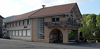
Mairie Saint-Maurice-sur-Moselle


Economy and Infrastructure
Saint-Maurice-sur-Moselle lives mainly from tourism, especially in the winter season. 16 farms are located in the community (cultivation of aromatic plants, dairy farming, breeding of horses, cattle, sheep and goats).
The national route 66 ( E 512 ) leading through the village follows the old trade route from Metz to Basel and leads east over the Col de Bussang to Mulhouse and in the north-west over Remiremont to Épinal .
Personalities
- Jacques Georges (1916–2004), President of UEFA from 1983 to 1990
- Pierre Pelot (born November 13, 1945), French science fiction author
supporting documents
- ↑ Saint-Maurice-sur-Moselle on cassini.ehess.fr
- ↑ Saint-Maurice-sur-Moselle on insee.fr
- ↑ Farms on annuaire-mairie.fr (French)