Madonne-et-Lamerey
| Madonne-et-Lamerey | ||
|---|---|---|
|
|
||
| region | Grand Est | |
| Department | Vosges | |
| Arrondissement | Epinal | |
| Canton | Darney | |
| Community association | Mirecourt Dompaire | |
| Coordinates | 48 ° 13 ' N , 6 ° 14' E | |
| height | 294-433 m | |
| surface | 7.02 km 2 | |
| Residents | 401 (January 1, 2017) | |
| Population density | 57 inhabitants / km 2 | |
| Post Code | 88270 | |
| INSEE code | 88281 | |
 Town hall and school building |
||
Madonne-et-Lamerey is a French commune in the department of Vosges in the region of Grand Est (2015 Lorraine ). It belongs to the Arrondissement Épinal and the municipal association Mirecourt Dompaire, founded in 2017 .
geography
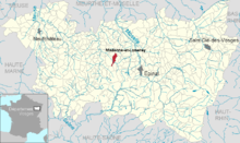
The municipality of Madonne-et-Lamerey with 401 inhabitants (January 1, 2017) is located on the Gitte , a tributary of the Madon , about 18 kilometers west of Épinal and twelve kilometers southeast of the small town of Mirecourt .
The area of the municipality is long; it reaches a north-south extension of six kilometers. The settlement area of the neighboring municipality of Dompaire connects seamlessly to the center of Madonne-et-Lamerey.
Neighboring communities of Madonne-et-Lamerey are Bouzemont in the north, Derbamont and Circourt in the northeast, Damas-et-Bettegney in the east, Ville-sur-Illon in the south and Dompaire in the west.
history
The area of today's municipality was part of the Madonne ban , which also included the villages of Lamerey, Naglaincourt, Craincourt and Chenimont . The ban was under the Bailiwick of Dompaire , the abbesses of the Chapitre de Remiremont exercised the high and low jurisdiction . There is no church in Madonne-et-Lamerey. The residents used to be parish in Laviéville . In 1793 the spelling of the place name was Madonnes , in 1801 it was still Madonne et la Mercy .
Population development
| year | 1962 | 1968 | 1975 | 1982 | 1990 | 1999 | 2007 | 2017 | |
| Residents | 464 | 441 | 401 | 404 | 375 | 384 | 384 | 401 | |
| Sources: Cassini and INSEE | |||||||||
Attractions
There are no churches or chapels in Madonne-et-Lamerey.
Economy and Infrastructure
Six farms are located in the municipality (cultivation of grain as well as tree, bush and nut fruits, dairy farming).
The two-lane department road D 166 from Épinal to Mirecourt / Neufchâteau runs between today's village center and the hamlet of Lamerey . At the nearby Dompaire junction, the D 28 / D 3 branches off to Vittel and to the A31 autoroute .
supporting documents
- ↑ Madonne-et-Lamerey on vosges-archives.com ( Memento of the original from March 4, 2016 in the Internet Archive ) Info: The archive link was inserted automatically and has not yet been checked. Please check the original and archive link according to the instructions and then remove this notice. (PDF file, French; 105 kB) - no longer available since 2014
- ↑ toponym on cassini.ehess.fr
- ↑ Madonne-et-Lamerey on cassini.ehess.fr
- ↑ Madonne-et-Lamerey on insee.fr
- ↑ Farms on annuaire-mairie.fr (French)


