Darney
| Darney | ||
|---|---|---|

|
|
|
| region | Grand Est | |
| Department | Vosges | |
| Arrondissement | Neufchâteau | |
| Canton | Darney | |
| Community association | Vosges Côté Sud Ouest | |
| Coordinates | 48 ° 5 ' N , 6 ° 3' E | |
| height | 260–351 m | |
| surface | 7.92 km 2 | |
| Residents | 1,092 (January 1, 2017) | |
| Population density | 138 inhabitants / km 2 | |
| Post Code | 88260 | |
| INSEE code | 88124 | |
 Location of Darney in the Vosges department |
||
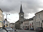
Darney is a French commune with 1,092 inhabitants (as of January 1, 2017) in the Vosges department in the Grand Est region ; it belongs to the arrondissement Neufchâteau and is the main town (chef-lieu) of the canton Darney .
geography
The municipality of Darney on the upper Saône - only a few kilometers from its source - is located between the southern Lorraine thermal baths of Vittel and Bains-les-Bains .
Neighboring municipalities of Darney are Bonvillet in the north and northeast, Belrupt in the east, Hennezel in the southeast, Attigny in the south and southwest, Belmont-lès-Darney in the west and Relanges in the northwest.
history
Darney was called Daren Haye in ancient times , Celtic for entrance to the forest . Later the community was called "Darney aux trente tours"; Not much of the 30 towers has survived.
In 1918 French President Raymond Poincaré declared the independence of Czechoslovakia in Darney . The former Hôtel de Ville is now a French-Czechoslovak museum, in which the declaration of independence is kept in particular.
Population development
| year | 1962 | 1968 | 1975 | 1982 | 1990 | 1999 | 2007 | 2016 |
| Residents | 1810 | 1930 | 1922 | 1736 | 1534 | 1339 | 1238 | 1107 |
Town twinning
- Slavkov u Brna , Czech Republic, since 1985 (former name: Austerlitz)
Personalities
- The French theologian Nicolas-Sylvestre Bergier (1718–1790) was born in Darney.
- Jean-Baptiste Bresson (1760-1832), lawyer and deputy in the National Convention , comes from Darney.
Web links
- Darney on lorraineaucoeur.com


