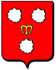
Maconcourt
| Maconcourt | ||
|---|---|---|

|
|
|
| region | Grand Est | |
| Department | Vosges | |
| Arrondissement | Neufchâteau | |
| Canton | Mirecourt | |
| Community association | Ouest Vosgien | |
| Coordinates | 48 ° 22 ′ N , 5 ° 56 ′ E | |
| height | 318-455 m | |
| surface | 5.48 km 2 | |
| Residents | 75 (January 1, 2017) | |
| Population density | 14 inhabitants / km 2 | |
| Post Code | 88170 | |
| INSEE code | 88278 | |
 Town hall and school building |
||
Maconcourt is a commune in the French department of Vosges in the Grand Est region (before 2016: Lorraine ) at 340 meters above sea level . It belongs to the canton of Mirecourt in the Neufchâteau arrondissement . It is bordered by Vicherey to the north-west, Beuvezin to the north-east, Aboncourt to the east, Saint-Prancher to the south, Dommartin-sur-Vraine to the south-west and Rainville to the west . The residents call themselves Maconcourtien (ne) s.
Population development
| year | 1962 | 1968 | 1975 | 1982 | 1990 | 1999 | 2008 | 2014 |
|---|---|---|---|---|---|---|---|---|
| Residents | 101 | 111 | 92 | 88 | 78 | 63 | 95 | 85 |
Attractions
- War memorial
- Saint-Martin Church, built in 1774
- Ferrières chapel
Web links
Commons : Maconcourt (Vosges) - Collection of images, videos and audio files


