
Bleurville
| Bleurville | ||
|---|---|---|

|
|
|
| region | Grand Est | |
| Department | Vosges | |
| Arrondissement | Neufchâteau | |
| Canton | Darney | |
| Community association | Vosges Côté Sud Ouest | |
| Coordinates | 48 ° 4 ′ N , 5 ° 58 ′ E | |
| height | 248-383 m | |
| surface | 20.25 km 2 | |
| Residents | 308 (January 1, 2017) | |
| Population density | 15 inhabitants / km 2 | |
| Post Code | 88800 | |
| INSEE code | 88061 | |
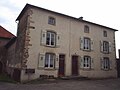
 Mairie Bleurville |
||

Bleurville is a French commune with 308 inhabitants (as of January 1, 2017) in the Vosges department ( Grand Est region ). Belmont-sur-Vair is part of the Neufchâteau arrondissement and the Darney canton .
geography
Bleurville is located in the Monts Faucilles , near the headwaters of the Saône and is surrounded by the neighboring communities Viviers-le-Gras and Provenchères-lès-Darney in the north, Nonville and Attigny in the east, Monthureux-sur-Saône in the south, and Saint-Julien in the Southwest, Tignécourt in the west and Serocourt in the northwest.
Population development
| year | 1962 | 1968 | 1975 | 1982 | 1990 | 1999 | 2007 | 2014 |
| Residents | 508 | 473 | 453 | 445 | 396 | 359 | 361 | 353 |
Attractions

Main square in Bleurville

Saint-Pierre-aux-Liens church, Monument historique
Priory


Web links
Commons : Bleurville - collection of images, videos and audio files