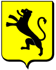
Dombrot-sur-Vair
| Dombrot-sur-Vair | ||
|---|---|---|

|
|
|
| region | Grand Est | |
| Department | Vosges | |
| Arrondissement | Neufchâteau | |
| Canton | Vittel | |
| Community association | Terre d'Eau | |
| Coordinates | 48 ° 16 ' N , 5 ° 53' E | |
| height | 310-399 m | |
| surface | 9.04 km 2 | |
| Residents | 245 (January 1, 2017) | |
| Population density | 27 inhabitants / km 2 | |
| Post Code | 88170 | |
| INSEE code | 88141 | |
 Mairie Dombrot-sur-Vair |
||
Dombrot-sur-Vair is a French commune with 245 inhabitants (as of January 1, 2017) in the Vosges department in the Grand Est region (until 2015 Lorraine ). The municipality belongs to the Arrondissement Neufchâteau and the municipality association Terre d'Eau .
geography
Dombrot-sur-Vair is located between the Xaintois and Bassigny landscapes on the Vair River , about ten kilometers northwest of Vittel . The community consists of the two elongated districts Rue des Saints on the right bank and Rue de l'Église on the left bank of the Vair. Dombrot-sur-Vair is surrounded by the neighboring communities of La Neuveville-sous-Châtenois in the north, Houécourt and Gironcourt-sur-Vraine in the northeast, Belmont-sur-Vair in the east, Auzainvilliers in the south and southwest and Sandaucourt in the west.
Population development
| year | 1962 | 1968 | 1975 | 1982 | 1990 | 1999 | 2008 | 2016 |
| Residents | 240 | 240 | 255 | 237 | 247 | 254 | 250 | 249 |
| Sources: Cassini and INSEE | ||||||||
Attractions
- Saint-Denis church, built in 1778 in place of a previous building
- Remains of a former monastery that was destroyed in the 15th century
- Saint-Martin chapel
- two wells
Economy and Infrastructure
There are five farms in the municipality of Dombrot-sur-Vair (cereal growing, dairy farming, goat and sheep breeding).
The trunk road from Houécourt to Contrexéville runs through the municipality of Dombrot-sur-Vair . There are connections to the A 31 autoroute in the municipalities of Bulgnéville and La Neuveville-sous-Châtenois , each six kilometers away . In the small town of Vittel , ten kilometers away , the nearest train station is on the Merrey – Hymont-Mattaincourt railway line .
supporting documents
- ↑ Dombrot-sur-Vair on cassini-ehess-fr
- ↑ Dombrot-sur-Vair on insee.fr
- ↑ Farms on annuaire-mairie.fr (French)

