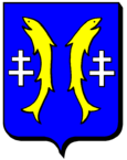
Châtillon-sur-Saône
| Châtillon-sur-Saône | ||
|---|---|---|

|
|
|
| region | Grand Est | |
| Department | Vosges | |
| Arrondissement | Neufchâteau | |
| Canton | Darney | |
| Community association | Vosges Côté Sud Ouest | |
| Coordinates | 47 ° 57 ' N , 5 ° 53' E | |
| height | 229-398 m | |
| surface | 9.21 km 2 | |
| Residents | 131 (January 1, 2017) | |
| Population density | 14 inhabitants / km 2 | |
| Post Code | 88410 | |
| INSEE code | 88096 | |
 Location of the commune of Châtillon-sur-Saône in the Vosges department |
||
Châtillon-sur-Saône is a French commune with 131 inhabitants (as of January 1, 2017) in the Vosges département in the Grand Est region (until 2015 Lorraine ); it belongs to the Arrondissement of Neufchâteau and the Canton of Darney .
geography
The commune of Châtillon is located at the mouth of the Apance in the Saône in the extreme south-west of Lorraine. It borders the Champagne-Ardenne region in the southwest and the Franche-Comté region in the southeast . Neighboring municipalities of Châtillon-sur-Saône are Lironcourt in the north, Grignoncourt in the northeast, Jonvelle in the southeast, Enfonvelle in the southwest and Fresnes-sur-Apance in the west.
history
In Châtillon there was a fortress that Count Henry III. , Count von Bar , ceded to Philip IV , King of France , in 1301 when he was in captivity. Around 1634 the place was destroyed by Swedish soldiers. After the reconstruction, Châtillon became the seat of a royal bailiff . From 1790 to 1801 the place was even the seat of a canton administration .
Population development
| year | 1962 | 1968 | 1975 | 1982 | 1990 | 1999 | 2007 |
|---|---|---|---|---|---|---|---|
| Residents | 270 | 236 | 226 | 201 | 176 | 179 | 160 |
Personalities
- Jan Monchablon (1854–1904), painter
